ASIA · MALDIVES GUIDE
Maldives Map & Atolls: Understand Islands, Regions and Distances

The Maldives map is most useful before you choose accommodation. It shows why two islands advertised with similar beaches can require very different journeys, and why a place described simply as “near Malé” needs a more precise address. Read the country as an extended chain of islands and reefs, rather than a single coastal destination.
Use the map for nationwide orientation and open the full-size version when you need to examine labels. It is not a navigation chart, a live passenger timetable or proof of access to a private island. This guide explains the main geographic names used in travel planning, then shows how to turn a location into the right questions about transport and the time available for your trip.
Read the archipelago from north to south
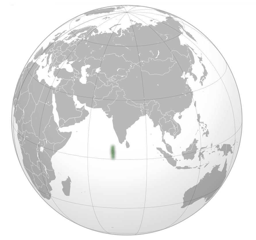
The official tourism geography overview describes an Indian Ocean country whose atoll chain spans the equator. Most of what separates the islands is water. A map that compresses the whole country into a small phone screen can make distant areas appear deceptively close, so check scale and the full national extent before interpreting a route.
Locate your international gateway first, then the actual island where you intend to sleep. Add any regional airport and the final local connection. Compare those points with the activities you hope to undertake. A distant attraction is not automatically a day trip from your chosen resort, and a label at national scale may represent an atoll rather than a specific island. Use the Attractions guide for the reason to visit a place, and this page to understand its position in the wider country.
Understand natural atolls, administrative names and island names
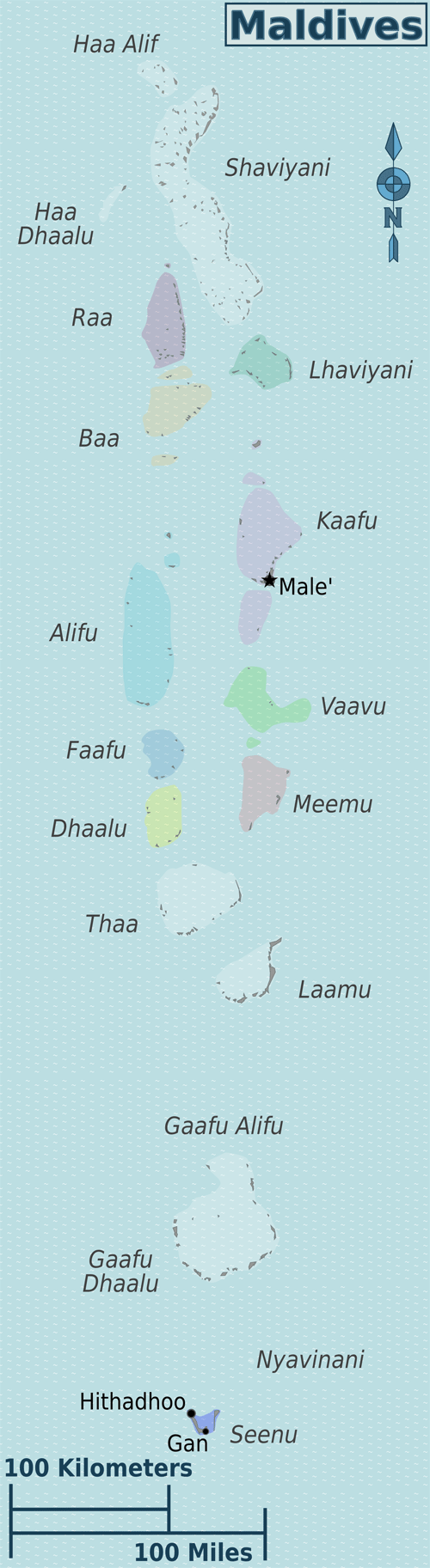
Official tourism geography uses a count of 26 natural atolls, while its geographic explanation distinguishes 20 administrative divisions. These describe different ways of organising the country, not two competing counts of the same visitor itinerary. A geographic atoll is a reef-and-island formation; an administrative name serves government and address purposes. City administration adds another layer to some current records.
Your accommodation may also use a tourism region, an island name and a commercial brand. Keep those details together instead of replacing one with another. North Malé and South Malé belong in the Kaafu planning context; Ari is commonly described as northern and southern parts, with Alifu Alifu and Alifu Dhaalu appearing in addresses. Ask a supplier to confirm the exact island when names are similar. A map search for the brand alone should not overrule the address on the confirmed booking.
Use the main travel regions as orientation points
| Area | Where to look on the map | Planning question |
|---|---|---|
| North and South Malé | The central-eastern gateway area around Malé | Which exact island and boat or other connection serves it? |
| Ari | West of the Malé-area atolls | Which northern or southern base fits the intended activity? |
| Baa | Northwest of the Malé area in the western chain | How do I reach the chosen island and protected-area excursion? |
| Northern atolls | The chain extending well north of the gateway | Does the additional journey suit the trip length? |
| Central and southern atolls | Southward through areas including Laamu and Huvadhoo | Which regional airport and final transfer are actually booked? |
| Fuvahmulah and Addu | The far-southern part of the country | What complete route and time allowance does this visit require? |
Scroll the table sideways to compare all columns.
This is an orientation table, not an exhaustive ranking or an operating network. Check the specific island and supplier route before inferring the transport mode from a region.
Separate Malé city, Hulhumalé and the wider Malé-area atolls
Malé is the capital city, not a shorthand for every island reached through the gateway airport. Hulhumalé is a different urban island, and the airport is another distinct point in the greater Malé area. The official local-island orientation guide describes the bridge connection linking the urban area and airport. That does not mean every accommodation sold under a Malé-region heading is reached by road.
North and South Malé contain a mix of local islands, private resorts and marine sites. The address must tell you which island you are actually booking. Ask whether the advertised transfer starts at the airport, an urban jetty or another meeting point. For an airport-area night, check the hotel’s actual location and both directions of the pickup. For the main beach stay, read Where to Stay to choose the base model, then confirm the connection for the individual property.
Distinguish Ari and Baa before choosing marine experiences
Ari lies in the western chain, separate from the Malé-area atolls. Northern and southern labels matter when discussing accommodation and excursions, but they do not replace a precise island address. If your aim is a particular reef or marine-life outing, ask an operator based at your chosen island whether it offers that trip, how conditions affect it and how much of a day it requires. A broad regional association is not a promise that every property provides the same experience.
Baa is farther north in the western chain. UNESCO’s Baa Atoll entry identifies its biosphere-reserve status; this differs from a World Heritage inscription. Hanifaru is a specific protected-area destination within the Baa context, not another name for the entire atoll. Confirm its applicable access arrangements with a responsible operator. Keep geographic understanding, conservation designation and a saleable excursion separate so that a meaningful place name does not become an unrealistic booking expectation.
Give northern and southern journeys enough time
The northern atolls extend well beyond the central gateway region. To the south, the chain continues through further atolls to Huvadhoo, Fuvahmulah and Addu. These places should not be treated as interchangeable extensions of a short stay near Malé. A regional airport can shorten one part of the journey, but the whole trip may still include a flight, local transfer and waiting time that needs to fit the itinerary.
Choose a more distant region because it supports a clear interest or a property you want, rather than an assumption that remoteness automatically means better beaches or fewer people. Compare a complete one-base stay there with a split stay that returns through a hub. On a longer holiday, accepting another travel stage can be worthwhile. On a short break, the same stage can consume time you intended for the island. Use the itinerary guide to make that tradeoff explicit.
Turn the map into a checked route, not an invented connection
A straight line between two islands says nothing about passenger availability, access permission or safe conditions. Ask whether the journey is direct, which operator runs it and where the service actually departs. A resort may require a prearranged guest transfer, while a public route to a nearby local island may not provide the last section. Static geography remains useful even when schedules change, but it cannot replace the current operator confirmation.
For each move, record the origin island and jetty, destination, travel date, service, luggage rules and change contact. Read Ferries & Island Transfers for a practical route record and Airports & Arrival Transfers for the international handover. Keep a full-size map available offline if it helps you explain your location. Use official and operator instructions for navigation and departure decisions, rather than attempting to navigate a vessel or plan a risky connection from this national overview.
Frequently asked questions
Why do references mention both 26 and 20 Maldives atolls?
The tourism geography convention describes 26 natural atolls and distinguishes 20 administrative divisions. They serve different purposes. Address and city-administration names can add further detail, so identify the exact island rather than treating either number as a list of holiday bases.
Is Malé the same as my resort’s Malé Atoll address?
No. Malé city is a specific place, while a resort may be on another island in the wider regional context. Confirm the island name, gateway and complete transfer instead of inferring road access from the word Malé.
Can I calculate boat time from the map distance?
Do not use map distance as a passenger timetable. The available route may use a hub, different ports or a property transfer, and conditions affect operations. Ask the actual operator for the route and appropriate timing.
Is Baa Atoll a UNESCO World Heritage site?
Baa has a UNESCO biosphere-reserve designation. That is a different programme from World Heritage inscription. Use the official designation and check the particular protected area’s visitor arrangements when booking an activity.