INDONESIA · BALI TRAVEL GUIDE
Kintamani and Lake Batur Photography: Reading the Caldera
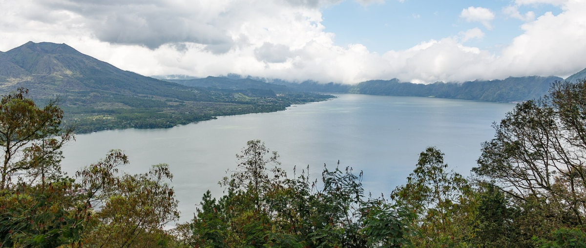
Lake Batur stretches across the centre of this wide photograph, with vegetation in the foreground and higher land around the water. The source identifies Lake Batur and places Mount Batur towards the left side of the scene, recording the photograph in 2015. “Kintamani” describes the wider highland area; it is not the name of one mountain shown here.
Distinguish the lake, volcano and caldera
The Indonesian tourism authority’s Kintamani overview places Mount Batur and Lake Batur within a volcanic caldera landscape. That relationship is more useful to a photographer than treating the scene as an isolated peak. Water, slopes and the enclosing high ground contribute different shapes to a broad view.
This image does not establish the exact camera coordinates or a named viewing terrace. Use it to understand the landscape rather than as directions to an unverified roadside stop. The Bali map provides wider orientation, and the outdoor guide separates a scenic viewpoint from a walking or mountain activity.
Build depth with foreground and distance
Branches and leaves help the viewer distinguish the near side of the frame from the lake. The far slopes then create another layer. Including foreground can make a large volcanic landscape easier to read, but too much foliage may hide the water’s outline. Check whether each included branch helps the composition or only breaks up the view.
A long, narrow frame can suit a lake and surrounding ridges. It also makes a tilted horizon or an accidental cut at the edge more obvious. Before changing settings, look across the complete frame and decide which slopes and shoreline shapes are essential. A modest change of position may improve the composition more than a wider lens.
Allow for changing visibility
Clouds and haze soften parts of the distance in this photograph. Those conditions do not make the view less valid, but they change its character. Clearer air may reveal more terrain, while cloud layers can simplify the landscape and draw attention to the lake. Neither outcome can be promised for a chosen date.
Keep the highlands separate from the coast when packing and planning. Bring a layer for cooler conditions, protect equipment from rain and allow time to wait if visibility changes. Do not improvise a stop on a narrow road simply because a gap in the clouds appears. Use a lawful, stable viewing position with space to stand clear of vehicles.
Do not turn a scenic stop into an unplanned climb
A photograph from an elevated viewpoint does not prove that its maker climbed Mount Batur. Choose a viewpoint visit or a trek according to your own plans, mobility and the current operating conditions. Volcanic alerts and local closures require a fresh check; this 2015 picture is not evidence that a route is currently open.
For a realistic day, consider the journey from your base and leave time for the return rather than adding several distant coastal stops. The Day Trips guide helps with that wider decision. The photographic aim can remain simple: make a clear record of the lake and its surrounding landforms.
Frequently asked questions
Is Kintamani the name of the volcano in this photograph?
Kintamani is the wider highland area. The source identifies Lake Batur and Mount Batur within the volcanic landscape.
Can the exact viewing location be copied from this image?
No exact camera coordinates are established by the available source. Choose a lawful viewing area rather than using the photograph as roadside directions.
Do I need to climb Mount Batur to photograph Lake Batur?
A scenic viewpoint and a mountain trek are different activities. This photograph does not establish that the photographer climbed the volcano.