
CHINA · SHANGHAI GUIDE
Shanghai Map & Neighbourhoods: Understand the Two Banks
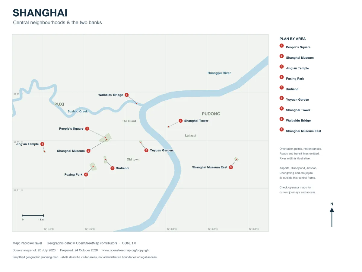
The full map opens in a new tab. Use the browser’s image zoom to inspect its natural resolution.
Start with the river. Puxi refers broadly to the west side of the Huangpu and Pudong to the east; neither is a small single neighbourhood. Many first-visit places are concentrated in central Puxi, while the Lujiazui skyline occupies the opposite bank. The geographic map above focuses on the central sightseeing area; it is not a live transport map.
Read the Map
North is at the top. The river lines and numbered places are derived from OpenStreetMap data retained with this guide. River widths are illustrative, and the numbered points are orientation positions rather than verified visitor entrances. Streets, metro lines, live services and administrative boundaries are omitted.
The map does not cover the whole municipality: Pudong Airport, Hongqiao Airport, Disneyland, Jinshan, Chongming and Zhujiajiao are outside its central frame. Use Airports & Transfers and Day Trips for those journeys.
Match Areas to the Shape of Your Day
On smaller screens, swipe or scroll horizontally to read the full table.
| Area | Where it sits in the visit | Natural planning link |
|---|---|---|
| Bund | Puxi bank of the Huangpu | East Nanjing Road and the northern old-town approach. |
| Old town / Yuyuan | South of the central Bund area in Puxi | Garden, teahouse exterior and old-town lanes. |
| People’s Square | Inland from the river in central Puxi | Major metro connections and Shanghai Museum’s central building, currently hosting the ticketed Americas exhibition. |
| Jing’an | Farther west in Puxi | Temple, shopping and a separate local dining session. |
| Sinan / Fuxing Park / Xintiandi | Southwest of People’s Square | Compact architecture and park walks. |
| Lujiazui | Across the Huangpu in Pudong | Tower district and east-bank riverside views. |
| Suzhou Creek | Flows into the Huangpu north of the main Bund | Selected bridges and industrial or cultural sites along separate segments. |
The neighbourhood descriptions are editorial orientation labels. For deciding where to sleep, use Where to Stay rather than treating this map as a hotel recommendation.
Why Straight-Line Distance Can Mislead
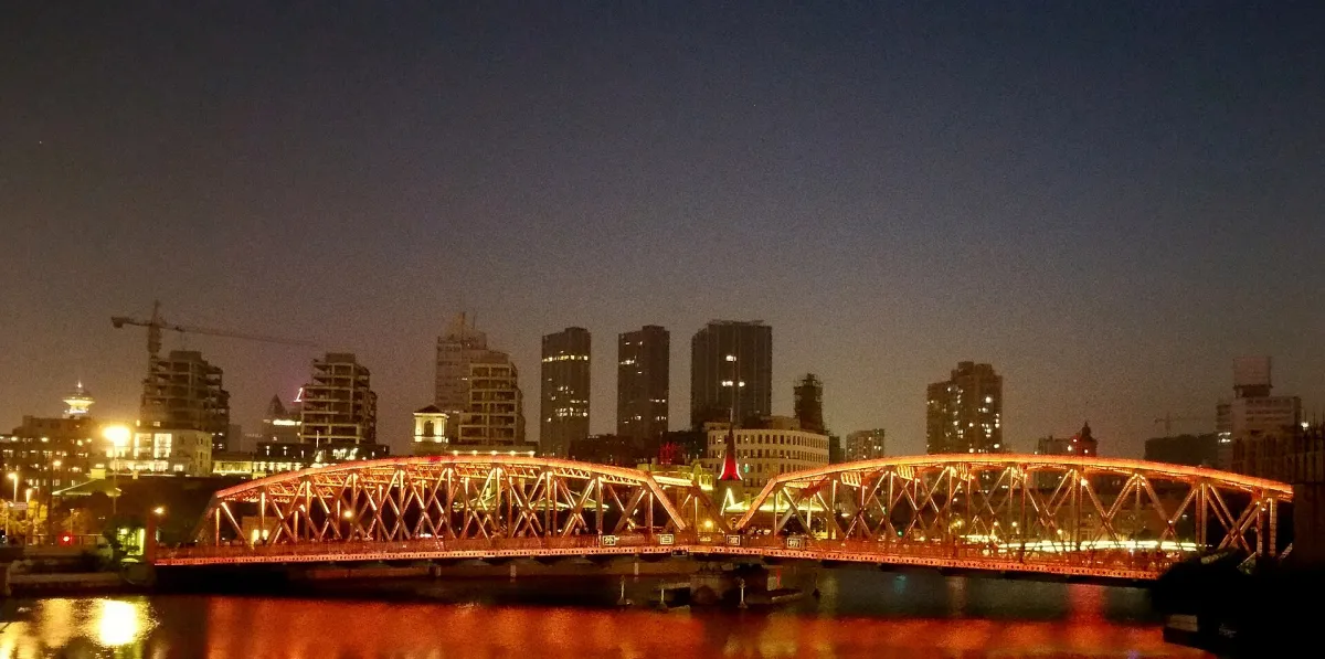

Two points facing each other across the Huangpu require a real crossing. A metro journey, public ferry and sightseeing cruise have different stops and purposes. Similarly, the name of a large station does not tell you which exit reaches the destination with the fewest crossings.
Shanghai Museum East and the Lujiazui towers are both in Pudong, but they are separate journeys. “Former French Concession” covers a historic area rather than one station. Check the actual address and entrance for each visit; use Getting Around to select the transport method.
Use the Geography to Reduce Transfers
Build one old-town and Bund day, one central Puxi and lane-street day, and one Pudong day. If you choose the ticketed Americas exhibition, it fits the central People’s Square session. If you want the permanent Chinese collection, plan Shanghai Museum East as a separate Pudong session, rather than attaching it to the lane walk. This leaves room for meals and rest without repeatedly switching banks.
The itineraries show the sequence. For a broader journey, the China Map & Regions guide places Shanghai within the Lower Yangtze and helps distinguish a local outing from a move to another national travel base.
Map Sources and Practical Limits
Map design: Photos4Travel. Geographic data: OpenStreetMap contributors under the Open Database Licence. The retained source snapshot is dated 28 July 2026; the map was prepared for this guide on 24 October 2026. It simplifies the city and does not establish legal access, live road conditions or transport operations.
Open the full-size version to inspect smaller labels. For a journey today, use the current operator information and a suitable navigation service. A geographic planning map cannot replace a reservation, accessible-route confirmation or a current ferry timetable.
Map & Neighbourhoods FAQs
Does this map show all of Shanghai?
No. It covers the central sightseeing area. Airports, distant coastal and island areas, theme parks and water-town excursions are outside the frame.
Are the numbered points visitor entrances?
They are geographic orientation positions derived from source data. Confirm the current entrance and accessible route before travelling.
Can I use the map as a metro timetable?
No. Streets and transport operations are omitted. Use the current operator map and service information for actual journeys.