
ASIA · CHINA GUIDE
China Map & Regions: Choose Connected Travel Bases
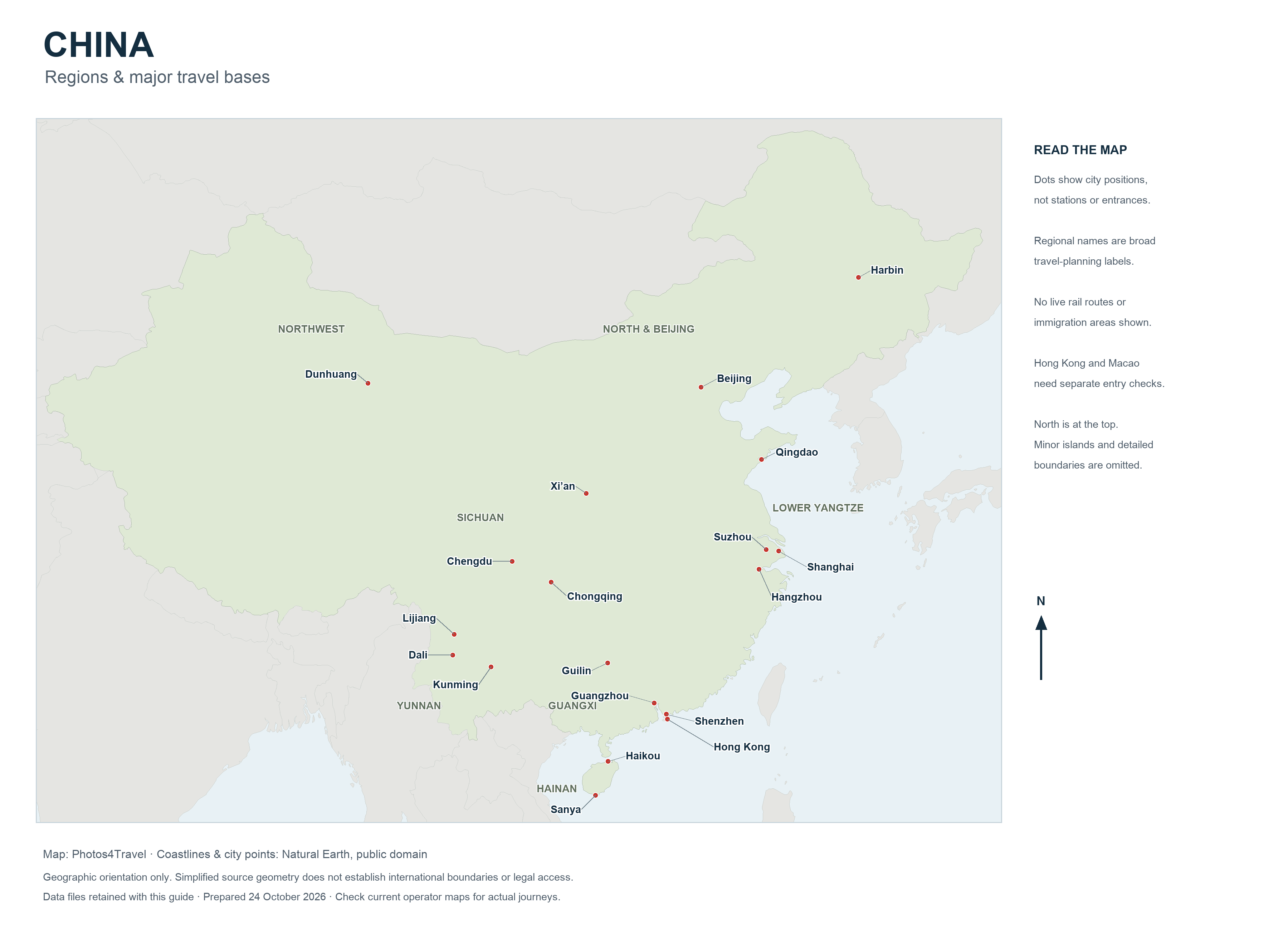
The full map opens in a new tab. Use the browser’s image zoom to inspect its natural resolution.
A small country map can hide the biggest planning problem in China: distances between major regions. The map above is an orientation tool built from Natural Earth coastline and city-point data. It shows selected bases and broad geographic relationships; it is not a live railway map, a visa-free transit boundary map or an entrance guide for individual attractions.
Use the high-resolution version to read city positions, then confirm each journey with the actual transport operator. A dot identifies the city’s general position, not your hotel, departure station or scenic-area gate. Hong Kong and Macao require separate entry checks; regional labels here describe travel planning areas rather than administrative or immigration permissions.
How to use the map
Start by marking your international arrival and departure cities. Next choose one additional region that fits the trip’s length and purpose. Only then add short excursions around those bases. This sequence avoids a route that repeatedly crosses the country to collect famous names.
The map uses real geographic data with north at the top. Broad regional names help orientation, but the country contains more local variation than this simplified view can show. Minor islands, detailed boundaries and local roads are not represented. Never use the illustration to establish an international boundary, a hiking route or the permitted area of an entry scheme.
Keep three separate maps in your planning: this national orientation map, an operator’s current transport map and a detailed local map for your accommodation and final approach. They answer different questions. Save local addresses and screenshots for offline use, since the map service familiar at home may not behave in the same way on mainland networks.
Beijing and northern China
Beijing is the clearest starting base for imperial architecture, the Palace Museum, Temple of Heaven and accessible Great Wall excursions. The city is spread out, so even a Beijing-only stay needs realistic movement between districts. Great Wall sections are outside the central sightseeing area and require a separate outward and return plan.
Tianjin can add a distinct urban excursion where train times and interests fit, while Chengde is a more substantial extension with its own overnight and transport decisions. Do not treat all northern heritage sites as interchangeable day trips from the capital. A long journey each way may remove the time you intended to spend on site.
The northern coast, including Qingdao and Beidaihe, follows a summer seaside rhythm rather than Hainan’s tropical pattern. Winter trips to Harbin belong to a different climatic plan again. Compare regional forecasts and event dates before adding a northern destination solely because it appears on the same half of the map.
Shanghai and the lower Yangtze
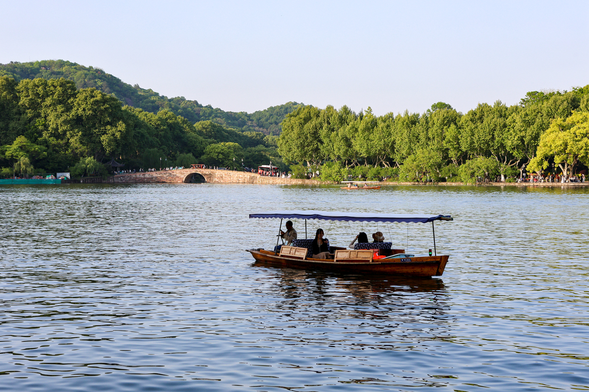
Shanghai, Suzhou and Hangzhou form a practical connected region for many first visits. Shanghai supplies the major-city base; Suzhou offers classical gardens and historic streets; Hangzhou introduces West Lake and tea-country excursions. High-speed rail can connect the cities, but each station-to-hotel journey still needs attention.
An overnight in Suzhou or Hangzhou changes the experience compared with a tightly timed day trip. Early and late hours allow slower neighbourhood exploration and reduce the pressure to fit several gardens or lake sectors into one afternoon. Choose between a stable Shanghai base and a split stay according to luggage, energy and your actual interests.
Huangshan and the historic villages of southern Anhui are worthwhile extensions, but they add a separate mountain or rural transfer problem. A station bearing a destination name is not proof that the scenic entrance is nearby. Reserve adequate nights and check the final road journey before combining them with a short Shanghai break.
Xi’an, Chengdu and the interior
Xi’an is an inland history base associated with the Terracotta Army, the city walls and earlier imperial capitals. It connects well with a classic Beijing–Xi’an–Shanghai itinerary when the actual train or flight works. The archaeological museum is outside the centre, so a visit needs its own transport and timed-entry plan.
Chengdu is a separate regional hub for Sichuan food, teahouses and excursions such as Leshan or Mount Qingcheng. Mountain destinations farther west should not be grouped into a single effortless day trip. Road approaches, altitude, weather and the need to return before an onward journey can all change the calculation.
Chongqing can be combined with Chengdu for travellers interested in two contrasting cities, but it is not simply another Chengdu district. Likewise, a Yangtze cruise is a product with its own embarkation point, schedule and included services. Match those details to your itinerary rather than assuming a route drawn beside the river represents a usable passenger service.
Guangxi and Yunnan
Guilin, Yangshuo and the Li River belong to Guangxi. Guilin often functions as the arrival or rail gateway, while Yangshuo suits a stay focused on rural landscapes and smaller-scale excursions. The station named Yangshuo is not in the middle of the town; check the onward road transfer to your actual hotel.
Longji rice terraces are a different landscape and approach from the river valley. An excursion can involve a substantial drive and walking between parking, village and viewpoints. If your aim is sunrise photography or an unhurried village stay, an overnight may be more useful than squeezing the terraces into a river day.
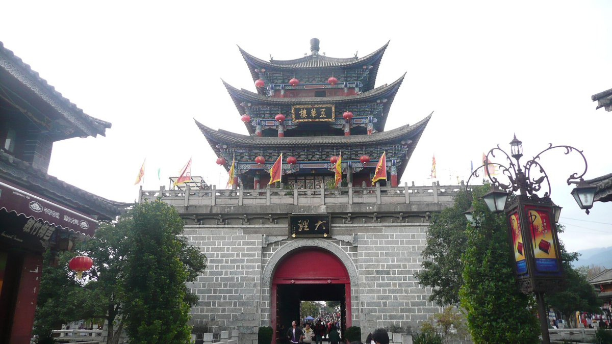
Yunnan supports a separate trip through bases such as Kunming, Dali and Lijiang. Higher-altitude extensions need additional preparation and may not suit every traveller. Use the province as a regional journey, not a quick add-on to Guangxi merely because both appear in the southwest. Weather and transport options should determine the sequence.
Southern cities, Hainan and separate entry areas
Guangzhou, Shenzhen and the Pearl River Delta offer urban, food and transport connections distinct from the Shanghai region. Hong Kong can be part of a broader journey, but crossing the boundary changes immigration and practical arrangements. Macao also has separate entry procedures. A train connection does not remove those formalities.
Hainan is an island trip. Sanya’s resort bays and Haikou’s city setting solve different holiday needs, and a flight to one does not place you next to a hotel in the other. The regional visa-free scheme for eligible travellers is also separate from general mainland arrangements; confirm the allowed area and onward plan with the National Immigration Administration.
For a beach extension, ask whether you want swimming, a resort pool, food within walking distance or a quieter waterfront. Those priorities can point to different bays even within Sanya. Consult the Beaches guide and Where to Stay comparison instead of choosing solely from the island’s position on a national map.
On smaller screens, swipe or scroll horizontally to read the full table.
| Combination | Why it works | Allow for |
|---|---|---|
| Beijing and Xi’an | Imperial and archaeological themes | An intercity transfer and separate museum approach |
| Shanghai, Suzhou and Hangzhou | Connected city, garden and lake experiences | Station transfers and a choice of day trips or overnight stays |
| Chengdu and nearby Sichuan | Food, urban culture and selected excursions | Road access and weather for each excursion |
| Guilin and Yangshuo | Gateway plus river-valley stay | Last-mile transport and variable visibility |
| Kunming, Dali and Lijiang | A coherent Yunnan journey | Altitude differences and repeated hotel moves |
Map & Regions FAQs
Does the map show high-speed rail routes?
No. It shows geographic orientation and selected city locations. Use China Railway 12306 for the actual station pair, timetable and booking conditions.
Can I use the regional labels to check visa-free transit limits?
No. Immigration permissions use the official current list of ports and permitted areas, which can differ from broad travel regions. Check the NIA rules for your exact route.
Why does the high-resolution map open fitted to the screen?
Browsers commonly fit a large image to the window first. Open the full image and use the browser’s image zoom to inspect its natural resolution; the preview remains a lighter version for reading the article.