
Sign in
For Photos4Travel editors and team members.
Hawaii · Hawaiʻi Volcanoes National Park Photography
Hawaiʻi Volcanoes National Park Photography: Landscapes Beyond Lava
Hawaiʻi Volcanoes National Park is worth photographing even when visible molten lava is not part of the visit. Landforms, vegetation, weather and the surface of cooled flows can tell a fuller story than a single eruption image. Plan around the park’s current open areas and let the actual landscape determine the photographs.
On this page · 4 sections ShowHide

Establish the scale before looking for details
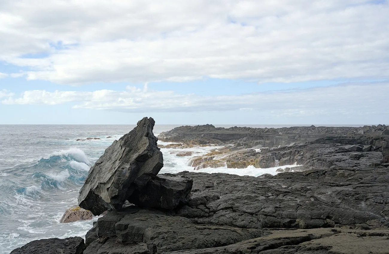
Trougnouf’s reference shows Pacific surf meeting a cooled lava coast near Āpua Point. A large angular rock anchors the foreground while lower dark formations continue along the shore. The source identifies lava from 1969–1974; this is an old lava landscape, not a photograph of molten lava reaching the sea today.
Begin with a wider scene that shows the relationship between land, sky and vegetation where those elements are visible. Decide which part carries the photograph: a landform, a change in surface or the way weather obscures and reveals distance. You do not need to include everything in one frame.
Then look for a smaller subject from the permitted route. Surface patterns can provide a useful second image beside a broad landscape. The separate pāhoehoe photo companion focuses on texture; this page supports the wider park outing.
An eruption photograph is not an access forecast
Check current National Park Service alerts before travelling and again before setting out within the park. Volcanic activity, roads and viewing areas can change. Do not follow a historical image, an old map pin or another visitor beyond a current closure.
Visible lava cannot be guaranteed, and a historical eruption photograph must remain labelled as historical when its date is known. The presence of steam, cloud or haze in an image does not by itself identify a particular event. Use official interpretation for geological context and keep the caption within what the record supports.
Plan a complete park day
The park is on Hawaiʻi Island, not Oʻahu. Consider where you will sleep, the outward and return drive, daylight and any supplies needed along the route. A long coastal resort transfer followed by a late photographic return can be tiring; the map guide helps assess a split stay.
Carry layers appropriate to the day and protect equipment from rain. Pay attention to footing before lifting the camera: uneven lava, cracks and edges deserve your full attention. A safe public viewpoint is the right place to compose; a dramatic-looking edge is not an invitation to approach.
For drone or commercial-photography plans, ask the park about current rules and permissions. Owning a small aircraft or a general pass does not establish permission to operate it in a national park. Choose a ground-based plan that remains worthwhile if weather or access changes.
Frequently asked question
Can I plan this visit around photographing flowing lava?
Treat lava viewing as uncertain. Eruption activity and legal viewing access change; build a worthwhile plan around the park’s open landscapes and current official guidance.