
Sign in
For Photos4Travel editors and team members.
Hawaii · Sacred places
Sacred Places in Hawaii: Visit Heritage Landscapes with Care
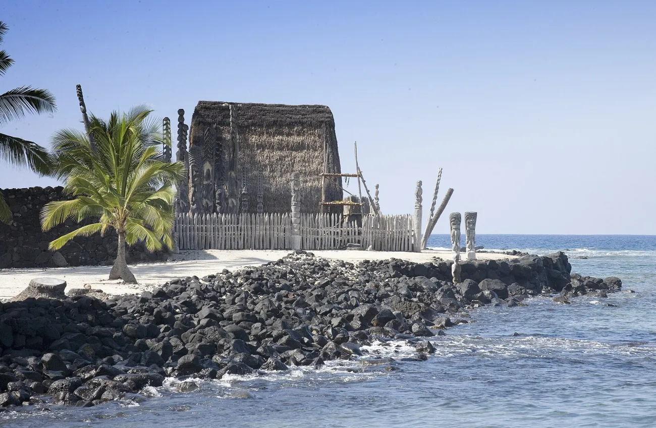

A sacred place is not simply a scenic stop with an older story. In Hawaii, a coastal refuge, a heiau and a petroglyph field can remain meaningful to families and practitioners today. A worthwhile visit begins with the site’s own interpretation and access rules. You can learn a great deal from the permitted route without entering a restricted space, moving a stone or photographing a ceremony.
Access check, 10 November 2026: Hawaii State Parks is publishing storm-recovery closures and limited reopenings, including restrictions on Kauaʻi. Do not treat a park’s ordinary opening-hours panel as confirmation that it is currently open. Check the current State Parks notices and the individual site before travelling.
Choose interpretation and access before choosing a photograph
Begin with the island on which you are staying. The Hawaiʻi Island sites below are not short add-ons to an Oʻahu afternoon. They also occupy different parts of Hawaiʻi Island: Kona-side cultural landscapes, the Kohala area and Hawaiʻi Volcanoes National Park require separate ground plans. Use the island map before fitting them into a route.
On a small screen, swipe the table sideways to compare the sites.
| Place | Island | Why consider it | Essential check |
|---|---|---|---|
| Puʻuhonua o Hōnaunau | Hawaiʻi Island | A refuge and royal coastal landscape with interpretation | Current NPS access, permitted route and programme |
| Puʻukoholā Heiau | Hawaiʻi Island | A major temple landscape connected to Kamehameha I | Restricted structures and the actual public route |
| Puʻuloa | Hawaiʻi Island | Petroglyphs within a living cultural landscape | Trail access, uneven lava and staying on the viewing boardwalk |
| Wailua heritage sites | Kauaʻi | A former centre of chiefly power and religious sites | Storm-recovery access notices; no presumed open access |
Puʻuhonua o Hōnaunau: understand the refuge and royal grounds
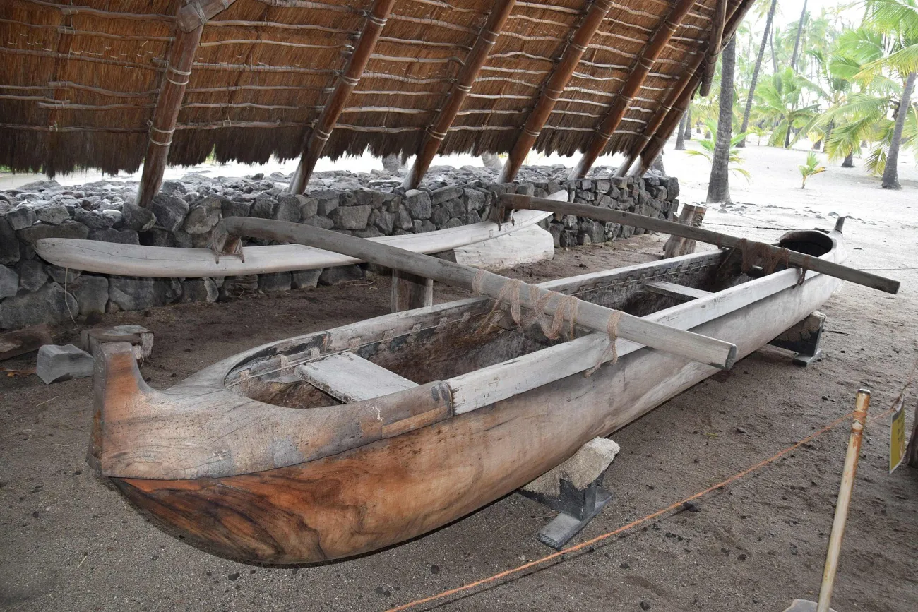

Puʻuhonua o Hōnaunau National Historical Park preserves a Kona-coast landscape that includes a place of refuge and royal grounds. Its importance is not confined to one photogenic structure. Read the National Park Service’s history and cultural interpretation before walking the site so the features relate to one another.
The park’s visitor information links directions, basic entry information, accessibility and cultural programmes. Choose the current route that suits your group. Exposed lava, heat and uneven surfaces call for more preparation than a quick roadside photograph; ask about the appropriate visit for anyone with mobility limits.
Do not treat the sacred area as an extension of a neighbouring swimming outing. Follow the site’s boundaries and instructions about clothing, activities, food and photography. If a cultural demonstration is scheduled, make time to listen before taking pictures. A person explaining a practice deserves the same attention as the landscape around them.
For photography, work with the public path and the light available from it. A wider frame can show the relationship between the coast, structures and open space. Avoid using people in a ceremony as foreground decoration, and do not step over a barrier to remove it from the picture.
Puʻukoholā Heiau: a place to interpret, not to climb
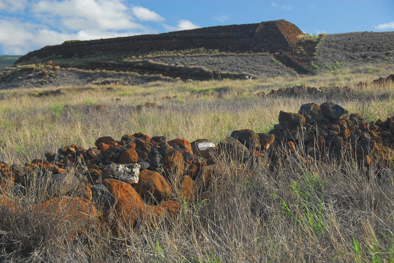

Puʻukoholā Heiau National Historic Site is associated with the rise of Kamehameha I. The heiau’s scale and position are part of the visit, but the site makes more sense when you begin with its political and spiritual context. The NPS historical account explains the relationships and conflicts behind its construction.
A heiau is a place of worship; the surviving stonework is not a viewpoint platform. Respect restrictions and photograph only from permitted positions. Do not climb for an unobstructed composition or move stones that appear loose. A useful image can include the visible route or boundary, which tells the truth about how visitors encounter the place.
Check the current visit guidance for the actual route and available services. Combine it with other Kohala-area plans only when the full day works geographically. It need not be rushed between a distant morning beach and a fixed evening reservation.
Puʻuloa: keep the petroglyphs beneath your view, not your feet
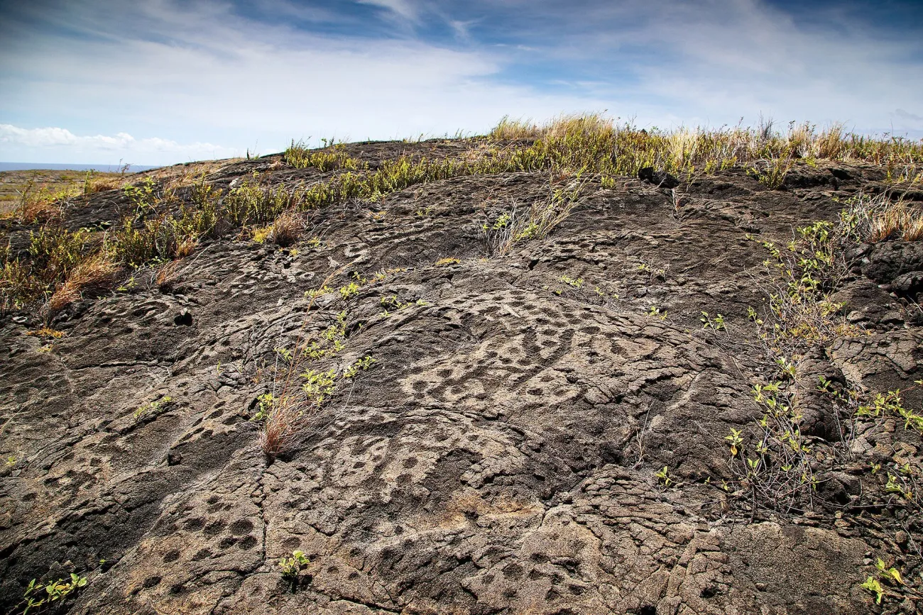

Puʻuloa is a sacred petroglyph landscape inside Hawaiʻi Volcanoes National Park. The official trail guidance describes an approximately 1.4-mile round trip across uneven lava to a viewing boardwalk. Treat the distance as a route description, not a promise that it will feel easy in heat, wind or rain.
The boardwalk protects fragile carvings. Stay on it at the petroglyph area, do not trace or rub the figures and do not add chalk, water or other materials to make a photograph clearer. Let the light reveal the surface. The NPS place interpretation explains why some marks relate to family and genealogical practices; they are more than decorative patterns.
Carry the supplies recommended by the park and check the day’s trail and road access. Footing demands attention. If taking a detail photograph, stop safely rather than moving backwards while looking through a screen. A standard lens from the allowed position is preferable to stepping off the boardwalk for a close-up.
Puʻuloa is distinct from a lava-viewing stop. A national-park visit can include both geological and cultural learning, but the current volcanic situation does not determine the value of this site. You do not need visible molten lava to have a meaningful day in the park.
Wailua: understand the landscape, then verify whether you may visit
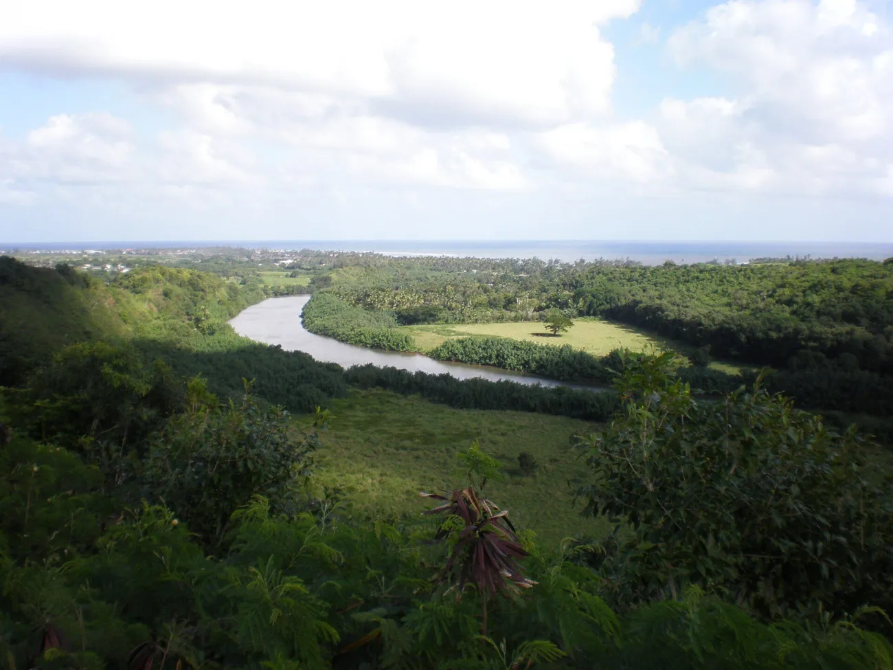

The Wailua area on Kauaʻi includes heiau, places of refuge and birthstones associated with a former centre of chiefly power. The State Parks page introduces this heritage alongside the river landscape. Its features should not be reduced to a quick photograph between waterfall stops.
Access requires particular care during storm recovery. State Parks pages checked on 10 November 2026 carry differing recovery updates, so their combined notices do not establish this site’s current status reliably. Confirm the specific site, approach and permitted activity with the manager before travelling. A boat product, road lookout and heritage-site visit can have different operating status; do not infer one from another.
If access is unavailable, choose another interpreted cultural visit on the island or spend time with official material instead. Do not walk around a locked gate, follow an unmarked path or use a map application to find an alternative entrance. The historical importance of a place does not override its current closure or custodians’ instructions.
What respectful visiting looks like in practice
Arrive ready to change plans. Read signs before setting up a camera, keep voices low where requested and leave room for other visitors and practitioners. A guide can explain the public story of a place, but permission to visit does not necessarily include recording every conversation or ceremony.
Leave stones, shells, plants and cultural objects where they are. Do not build a cairn as a souvenir photograph or copy an offering you have seen elsewhere. Practices have context, and an improvised gesture can harm a fragile site. If an object appears disturbed, tell staff rather than attempting a repair yourself.
For a portrait, ask. For a ceremony, wait for a clear invitation or put the camera away. For a commercial shoot, ask the land manager about the current permission process. Personal admission and commercial photography approval are separate matters, and equipment size alone does not answer which rules apply.
Travel TipRead one official interpretation page before you arrive and bring one specific question. It often changes a visit from “what am I looking at?” to a more useful conversation about the place.
Frequently asked questions about sacred places
Are all sacred places in Hawaii open to visitors?
No. Some have managed public access, while others are restricted, privately held or closed. Use the site manager’s current instructions and accept a boundary or closure.
May I leave a stone offering or build a small cairn?
Do not improvise offerings or move stones. Follow the site’s instructions and leave cultural and natural features in place.
Can I photograph petroglyphs at Puʻuloa?
Use the permitted viewing position and follow current park guidance. Stay on the protective boardwalk at the petroglyph area; never trace, rub or alter the carvings to improve an image.