
Sign in
For Photos4Travel editors and team members.
Hawaii · Pāhoehoe Lava Photography
Pāhoehoe Lava Photography: Read a Historical Aerial View
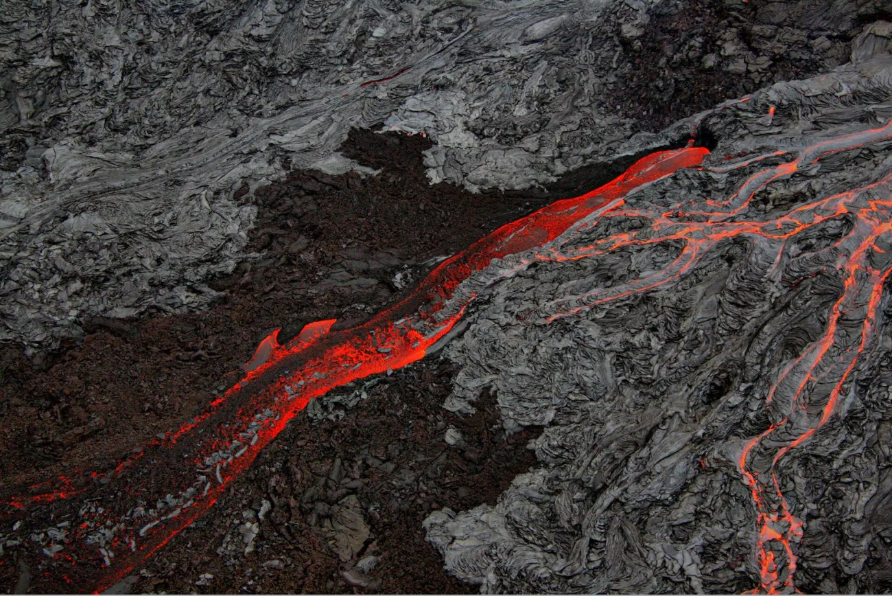
Brocken Inaglory’s historical photograph shows glowing lava cutting through dark surfaces on Hawaiʻi Island. The source identifies pāhoehoe and ʻaʻā flows and says the picture was made from a helicopter. This is an aerial reference of volcanic activity, not a ground-level route suggestion or evidence of what is visible today.
On this page · 4 sections ShowHide

Read the contrast between surface and glow
The bright red-orange lines create a diagonal movement through the frame. Around them, smoother folded-looking surfaces and rougher dark areas provide different textures. The colour is strongest where glow interrupts the grey and black landscape, so the eye follows that contrast before noticing smaller details.
A close crop might concentrate on one glowing line, while the wider reference makes the surrounding surface forms part of the story. Both approaches can be useful for studying the image. Neither allows an unqualified claim about the safety, temperature or stability of a particular surface encountered on a later visit.
Keep the source’s perspective and date limits clear
The helicopter viewpoint is essential context. A person on a public trail should not expect to reproduce this composition by walking closer to lava. The photograph does not identify a safe ground position or establish that a present-day sightseeing operator will fly the same route.
Keep the historical framing in the caption and source record. Do not present an eruption photograph as current merely because it looks dramatic. Where the record does not supply an exact event or camera setting, leave it unspecified rather than attaching a plausible eruption name.
Plan a current visit around official access
Use Hawaiʻi Volcanoes National Park’s current information for legal viewing areas and alerts. Eruptions and access change, and visible molten lava cannot be guaranteed. A worthwhile day can focus on cooled landforms, interpretation and open routes without needing an active-flow photograph.
For your own ground-based pictures, keep to the permitted route and pay attention to footing before composing. Do not leave a trail or cross a closure to find a closer texture. A longer focal length or a photograph of a lawful nearby surface can be a better decision than approaching an uncertain edge.
The separate park landscape companion studies an old lava coast and explains the wider outing. It serves a different purpose from this historical aerial image. The Photo Spots guide helps fit photographic interests into a realistic island trip.
Frequently asked question
Was this reference photographed from a public walking trail?
The source says it was photographed from a helicopter. Treat the viewpoint as historical aerial context and use current official guidance for any ground visit.