
SINGAPORE TRAVEL GUIDE
Singapore Map & Neighbourhoods: Find Your Base and Plan Routes
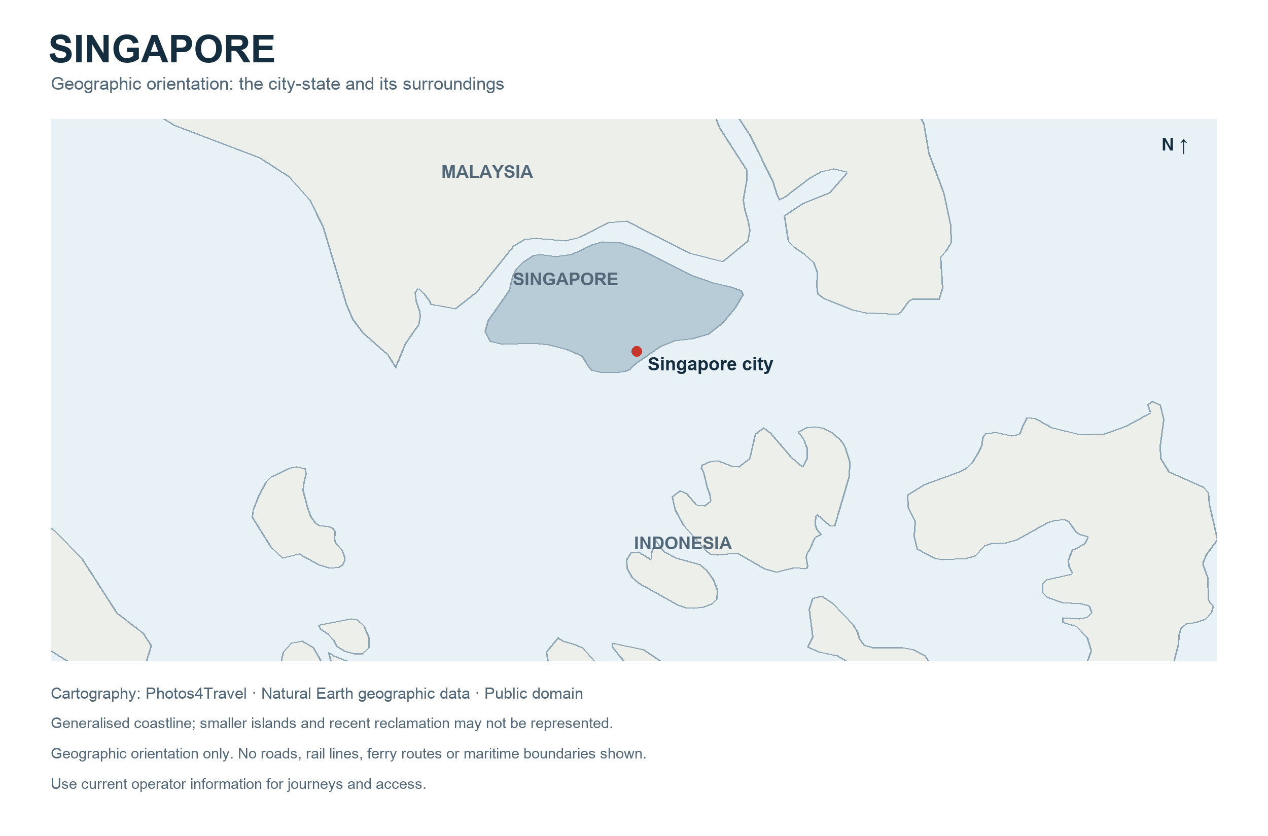
Select the map to open its large original. In the image tab, click once more for natural-size detail, or use your browser’s zoom controls.
Use Singapore’s geography to simplify the trip. The main visitor districts are connected by public transport, but they are not all adjacent, and a compact country still takes time to cross. A good plan groups places by area, distinguishes a station from the entrance you need and leaves room for tropical weather. This page provides a geographic overview rather than live navigation or a guarantee of current road and rail operations.
Read the map in practical zones
Marina Bay and the Civic District form a useful central orientation area. Chinatown and Tanjong Pagar lie on a different side of the central business district; Bugis, Kampong Gelam and Little India make another coherent cluster. Orchard Road extends the central shopping and hotel area. Changi Airport is in the east, while the Mandai wildlife attractions are well outside the bay’s immediate sightseeing zone.
Sentosa is a separate island connected to the main island through the HarbourFront area. Pulau Ubin requires a journey towards Changi Village and a boat crossing, not a train ride straight to its trails. These distinctions matter when assigning days. A map that places everything on one page can make distant attractions appear easier to combine than they are in practice.
Choose neighbourhoods by purpose
| Area | Useful for | Trade-off |
|---|---|---|
| Marina Bay and Civic District | Skyline, museums, waterfront and major hotels | Large developments and exposed walks |
| Chinatown and Tanjong Pagar | Heritage, hawker food and central connections | Street noise and room type vary |
| Bugis and Kampong Gelam | District walks, shops and Malay-Muslim heritage | Check the actual walk from the station |
| Little India | Markets, temples, food and varied accommodation | Busy streets and differing room standards |
| Orchard Road | Shopping, full-service hotels and indoor breaks | Less immediate access to some waterfront sights |
| Katong–Joo Chiat | Shophouses, food and an eastern neighbourhood stay | Repeated central trips need planning |
| Sentosa | Resorts, beaches and major family attractions | Extra movement to central neighbourhoods |
Scroll horizontally on smaller screens if needed.
Marina Bay and the Civic District
Start here when you want to understand the relationship between the river, historic civic buildings and modern waterfront. The area works well for a half-day walk with a museum break. It is less compact at pedestrian level than a skyline photograph suggests: bridges, entrances and large buildings influence the route. Choose the side of the bay that serves the activity you have booked.
Chinatown and Tanjong Pagar
Use these areas for food and heritage streets rather than treating them as a single attraction with one entrance. Telok Ayer, the streets around Chinatown station and the Tanjong Pagar side have different characters. A hotel may be convenient for one part while requiring a longer walk to another. The official historic district descriptions help explain how the urban fabric developed.
Bugis, Kampong Gelam and Little India
These districts can be paired across a day, with time for meals and an indoor pause. Avoid assuming that an underground interchange is a shortcut between every street. Pick the correct exit and use the surface route that suits your access needs. Around active places of worship, adjust the visit to the site’s visitor arrangements and keep entrances clear.
Orchard Road and the Botanic Gardens
Orchard Road is a long shopping corridor rather than one mall. Choose a section and identify the relevant station. Singapore Botanic Gardens is a large garden with multiple access points; the entrance near your chosen route matters. A morning in the gardens followed by an indoor lunch or shopping stop can work well, but do not underestimate the walk within the grounds.
Katong–Joo Chiat and the east coast
The eastern districts offer a slower alternative to bay-focused sightseeing. Combine a neighbourhood food walk with architecture and, if the weather suits, a separate coastal outing. Colourful houses can be private homes. Remain on public paths and do not turn a residential doorway into a photo set. Check the onward route before walking towards the coast on a hot afternoon.
Build routes that follow the geography
For a first central day, start in Chinatown, move towards the Singapore River and Civic District, then decide whether to continue to Marina Bay in the evening. This is a direction of travel, not a requirement to walk every metre. A rail journey or taxi can bridge a tiring section without breaking the logic of the route.
For another day, explore Little India before moving towards Bugis and Kampong Gelam. Give each area a purpose: a market, a temple exterior, a meal or a street walk. A third day can focus on gardens, museums or a major ticketed attraction. The main guide’s itineraries explain how to count full days separately from flight days.
Do not place Mandai, Sentosa and Pulau Ubin into one sightseeing day because they all appear as green areas on a country map. Each has its own approach, walking demands and return arrangements. Pick the outing that best fits your interests and reserve enough time to enjoy it.
Day trips from Singapore: choose the right outing
A Singapore day trip often means leaving the central districts for an island, a wildlife attraction or the coast, while keeping the same hotel. Choose the experience first, then work backwards from the return journey. An island on the map is not a promise of a quick transfer: reaching the pier, waiting to board and moving around after landing all belong in the day.
| Outing | Best fit | Allow and check |
|---|---|---|
| Pulau Ubin | Village atmosphere, nature and a quieter island landscape | A full day; on-demand bumboats, uneven routes and current trail notices |
| Sentosa | A beach break or one major ticketed attraction | Half a day for a simple beach outing; a dedicated day for a major attraction |
| Southern Islands | A picnic, coastal walking and a scheduled ferry excursion | A full day; the selected operator's island stops and last return sailing |
| Sungei Buloh | Mangroves, birdwatching and patient wildlife observation | Half to a full day; northwest approach, correct entrance and tide or flood notices |
| Mandai | A focused wildlife-park visit | A dedicated day or evening; the correct East or West precinct and separate attraction tickets |
| Katong and East Coast | Food, shophouses and a flexible coastal outing | Half to a full day; the last approach to the park and a comfortable return route |
Scroll the table horizontally on smaller screens if needed.
Pulau Ubin: make the boat journey part of the day


Travel towards Changi Village, then find Changi Point Ferry Terminal, 51 Lorong Bekukong. This is different from arriving at Changi Airport. NParks' visitor information lists the onward buses from MRT stations and explains the privately operated bumboats. Boats normally leave when enough passengers have gathered; a short crossing is not the total transfer time. Confirm the current fare and return arrangements before boarding, carry suitable cash and avoid building the outing around an assumed departure every few minutes.
Start with the village and choose a manageable route rather than automatically hiring a bicycle. Riders need to be comfortable with the actual surfaces and other traffic; a longer ride can be tiring in heat. Walkers can keep the day shorter. Check how you will get to and from Chek Jawa before leaving the village, and do not treat an exterior photograph of a jetty or boardwalk as proof of step-free boarding.
Current access matters: the official Ubin notices checked on 28 October 2026 describe a section of Chek Jawa's Coastal Loop closed for maintenance, with expected completion on 30 April 2027. The Mangrove Loop and open Coastal Loop sections remain available. A separate track closure applies, and the guided intertidal tour remains suspended. Follow the current notice maps and barriers rather than promising yourself the complete loop. Head back to the village with a generous return margin; do not attach this outing to a tightly timed flight.
Sentosa: choose a beach day or an attraction day
Use HarbourFront as the mainland approach. For Resorts World Sentosa, the Sentosa’s current arrival guidance describes the Sentosa Express from VivoCity Level 3 and the walking approach via the Sentosa Boardwalk. Beyond arrival, the location of the beach or attraction still matters. An entrance near Resorts World is not the same as reaching a beach.
For a relaxed outing, choose one beach area, allow for lunch and return before everyone is exhausted. For Universal Studios Singapore or Singapore Oceanarium, give the booked attraction the main part of the day and regard a later beach walk as optional. A cable-car ride is a different experience and purchase from ordinary access. In thunderstorms, stop exposed beach activity and move to appropriate shelter; the ticketed attraction's own rules determine whether its indoor areas remain available. Use the island's facilities and accessibility information to check the exact route and services you need.
Southern Islands: build the day around the return ferry
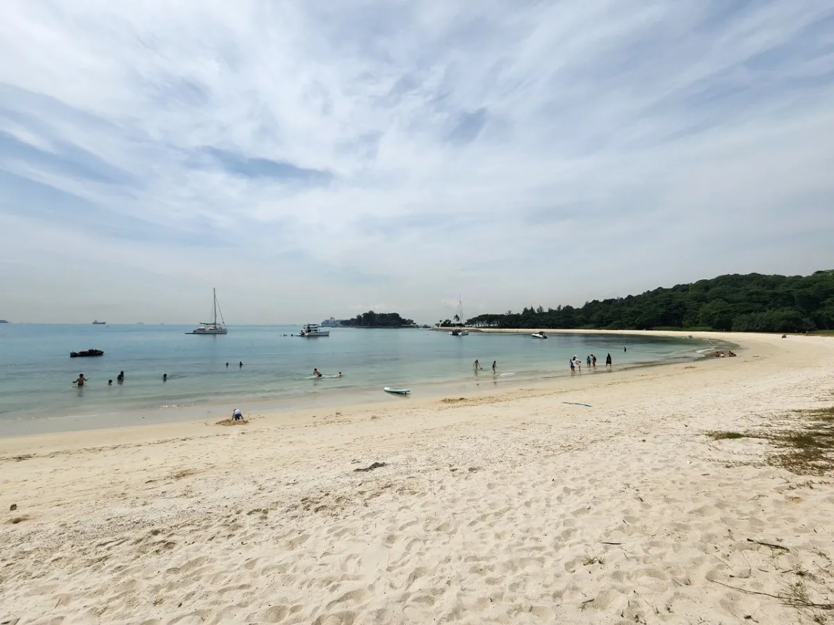

Begin at Marina South Pier, served by the MRT station of the same name. Decide which operator and ticket you are using before travelling there. The Singapore Land Authority's island guidance provides background on St John's, Lazarus and Kusu, but the actual ferry operator determines your sailing's landing points, sequence and return conditions. Island names on a broad tourism map are not interchangeable boarding instructions.
Choose a main purpose: a coastal picnic and walk, rather than racing to every island. Where your service lands at St John's, the onward walk to Lazarus is an additional part of the excursion. Confirm which jetty your return uses and whether a later island stop changes the direction of travel. Pack water, food, sun protection and a way to take rubbish back; do not rely on finding a full-service café wherever you stop. Weather, sea conditions and queues can change the day. Keep another day available for this outing and choose a mainland alternative when the forecast is unsuitable.
Sungei Buloh: a quieter northwest nature day
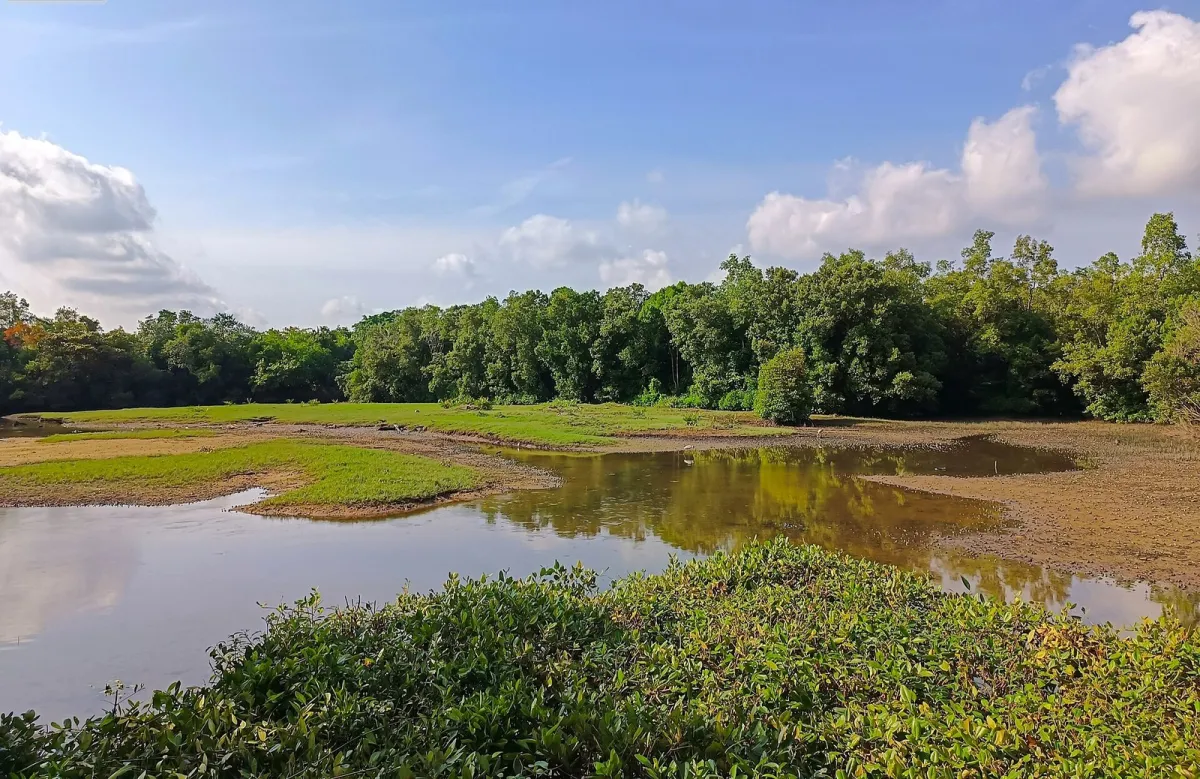

Sungei Buloh Wetland Reserve suits travellers who enjoy stopping, looking and listening rather than collecting many attractions. Choose the Visitor Centre or Wetland Centre deliberately and plan a return from that area. The current NParks page lists the Kranji MRT bus connections, including day-dependent services. A bus journey and the walk from its stop are separate parts of the route.
Start with a modest boardwalk or viewing-area circuit and let conditions determine whether you add more. Migratory birds are seasonal; no sighting is guaranteed. Read the tide and flood notices, stay behind barriers and give wildlife space. Although NParks lists wheelchair accessibility, confirm the particular entrance and circuit that meet your requirements. A long exposed circuit is not necessary for a rewarding visit. Have a rain plan before leaving central Singapore; a forested or flooded route is not an alternative shelter during bad weather.
Mandai: one main wildlife experience
Pick the park that interests you most and book its actual admission product. Singapore Zoo, Bird Paradise and Night Safari are different outings, not successive rooms within one attraction. If you choose an evening at Night Safari, preserve energy earlier in the day rather than automatically adding a full daytime park as well.
The official Mandai approach guide distinguishes East and West precincts and lists connecting buses, including the M2 service from Khatib. Tell a taxi or private-hire driver the exact attraction or drop-off point. Check how to return after your visit, especially after an evening session. Families and mixed-ability groups can simplify the day to one park, a long meal break and an unhurried return; transfers between precincts and walking inside the parks still take time.
Katong–Joo Chiat and East Coast: a flexible mainland alternative
Begin with a short shophouse and food walk in Katong–Joo Chiat, then decide whether the weather and your energy suit a separate visit to East Coast Park. The neighbourhood and the shoreline are related parts of the east, but not the same pedestrian destination. Check the actual park access point before setting off and use a bus or taxi for the connecting section when that makes the day more comfortable.
This is a useful choice when you want flexibility without a ferry booking. Leave time for a seated meal and do not combine a long coastal walk with an ambitious cycling session simply because both are available. Keep residential doorways clear and ask before close-up photographs inside a small business. If rain makes the coast unappealing, retain the neighbourhood meal and indoor break rather than forcing the original plan. The restaurant guidance and transport page help with the practical choices.
Malaysia and Indonesia: a different level of planning
Johor Bahru, Batam or Bintan can be worthwhile for travellers who specifically want an international visit, but they are not easy substitutes for a spare Singapore afternoon. Compare the complete journey: the approach to the checkpoint or ferry terminal, check-in, immigration on both sides, onward transport and the return. A ticketed ferry crossing or train ride is only one component. Border queues, weather and limited remaining sailings can turn a short visit into a long travel day.
Check the destination's official entry rules and your right to re-enter Singapore. The ICA entry page is the Singapore reference; an existing hotel booking or a previous admission does not itself establish re-entry permission. Keep passports and any required arrival submissions ready for the new crossing. For a short first visit to Singapore, a domestic outing usually gives more sightseeing for the time. Avoid an international excursion on a departure-flight day.
Use a static map and a live route planner together
The overview map helps explain spatial relationships. For the actual journey, consult a current route planner and the transport operator’s service notices. Station openings, engineering work, traffic and temporary access restrictions can change the best route. A historic map should never be presented as a current rail network diagram.
Keep the hotel pin offline and verify its street address. Some large complexes have a postal address far from the most useful pedestrian entrance. For a wheelchair or stroller, identify lifts and step-free approaches before setting out. A route that is shorter in distance may involve more stairs or less shelter.
At an interchange, compare the direction of the next train with the route shown in your planner before boarding. A destination may be one stop away but on a different branch. On a bus journey, identify the alighting stop and allow time to reach the door. These small checks are particularly useful when a map labels a whole district while your booking refers to one building within it.
Singapore map and neighbourhood FAQ
Is Marina Bay the best base for everyone?
No. It suits skyline and waterfront interests, while Chinatown, Bugis, Orchard or another area may fit your budget and daily routes better.
Can I reach Pulau Ubin by MRT?
You need an onward journey to Changi Point Ferry Terminal near Changi Village and a boat crossing. The island is not directly on the rail network.
Is the overview map a current transport map?
No. Use it for orientation, then check a current operator map and journey planner for the actual service.
Can I treat an island crossing as a guaranteed short day trip?
No. The mainland approach, exact sailing or bumboat arrangements, island route and return all matter. Check the chosen operator and park notices; a photograph or a boat ride duration does not establish a complete door-to-door itinerary.