
Sign in
For Photos4Travel editors and team members.
Virgin Islands · Walking & National Parks
Virgin Islands Hikes and National Parks: Choose the Right Walk
A Virgin Islands walk might be a short path through historic ruins, a climb above a dry headland or a long descent into a forested valley. The distances can look modest until heat, uneven ground and the climb back are included. Choose the kind of experience you want before choosing the longest trail. A shorter walk with time to understand the landscape often makes a better day than rushing a strenuous route to catch a ferry.
Compare the whole route, including the return
Check where a published distance starts and finishes. A beach access path, a headland extension and a complete round trip are different measurements. Include the time needed to reach the trailhead, stop for interpretation, find shade and get back to your transport. Walking downhill first is particularly deceptive: you still owe the uphill leg when the day is warmer and you are tired. Swimming at the bottom does not shorten the return.
Swipe or scroll sideways to compare the full table.
| Experience | Useful choice | Main planning issue |
|---|---|---|
| Short heritage visit | Annaberg or Cinnamon Bay, St. John | Sun, surfaces and time to read the site |
| Exposed coastal walk | Salt Pond and Ram Head, St. John | Heat, rocky footing and return distance |
| Long forest descent | Reef Bay, St. John | Steep climb back unless a specific guided return is booked |
| Upland forest | Sage Mountain, Tortola | Trail conditions and road pickup |
| Boulder passage | The Baths, Virgin Gorda | Climbing, wading and swell restrictions |
Choose for the least confident member of your party. The existence of a path does not make it suitable for every age, mobility level or weather condition.
Sage Mountain gives a BVI itinerary a different texture from bays and boat decks. The National Parks Trust describes the mountain as the highest point in the US and British Virgin Islands, at 1,710 feet, and explains the park's reforestation history. Look for the forest experience as well as the view: a clouded summit does not erase the interest of the vegetation and recovering landscape.
As checked on 19 November 2026, the official day-pass page lists visiting adults at US$5 and visitors under 18 at US$3, with small additional online service fees. Resident rates differ. Confirm current access and pay the correct category. Arrange the drive up and return before starting the walk, especially if using a taxi; a quiet park entrance is not a guaranteed place to find another vehicle. Allow for damp ground, roots and a cooler or wetter upland feel than at your beach accommodation. Follow the signed route and choose a turnaround appropriate to your party. Do not turn a forest outing into a promise of a clear panoramic photograph at an exact hour.
Short walks can reveal more than another beach stop
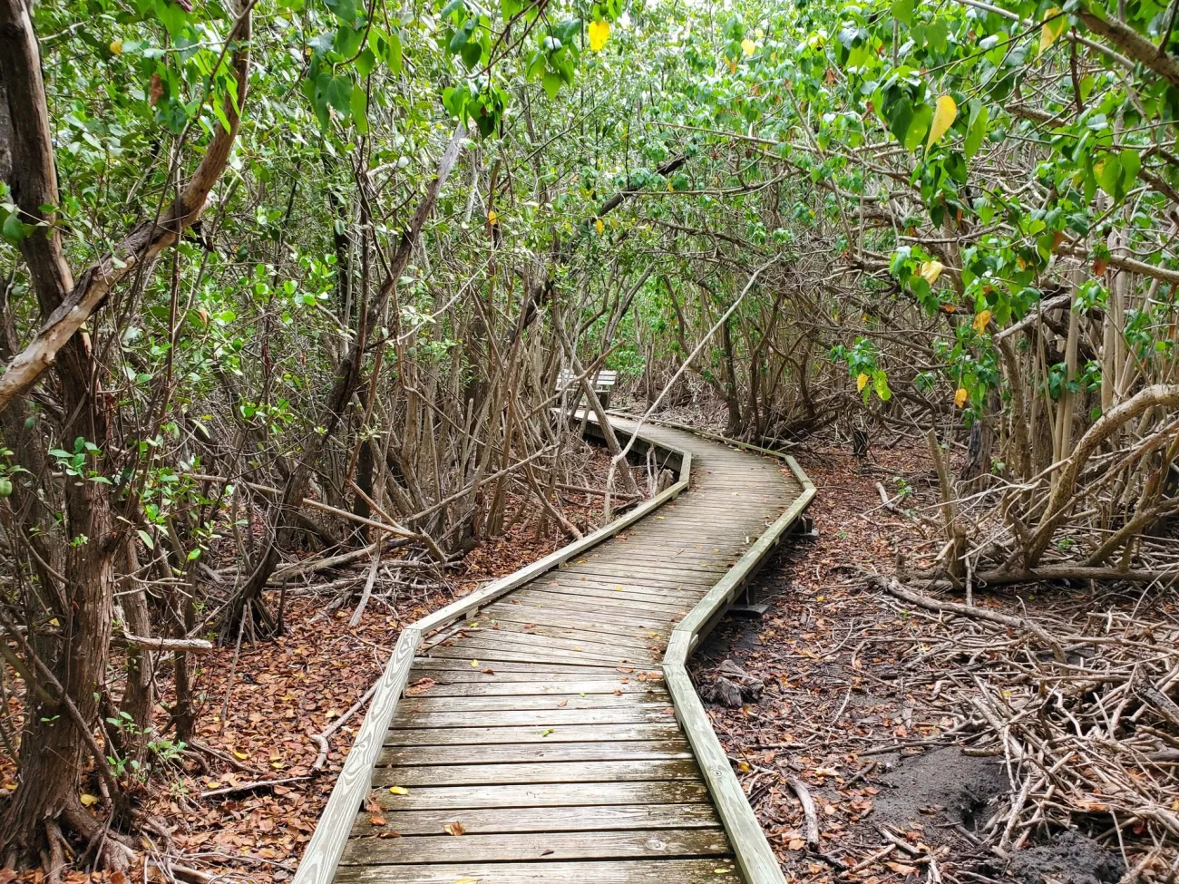
Photo: NPS/Parnicza · Public domain (U.S. Government work). Resized. No claim to original U.S. Government works.
St. John's plantation sites are a good choice when you want landscape and history without committing to an all-day hike. Allow time to read the interpretation and think about the people who worked the estates, not just photograph attractive stone walls. At Cinnamon Bay and Annaberg, a short visit can fit around a beach day while still giving the place its own attention. Arrive with shoes that can handle uneven surfaces rather than assuming the entire site is a pavement.
For mobility planning, the NPS accessibility page, updated in January 2026, identifies the Cinnamon Bay boardwalk, Francis Bay boardwalk and an accessible route through Annaberg. These are specific facilities, not a blanket statement that every park trail is accessible. The same page warns that beach ramps may be washed out by storms or high swell. Ask the park about the condition relevant to your visit and about the distance from parking or taxi drop-off. For families, a short trail with a clear turnaround can be more rewarding than setting a distant summit as the only measure of success.
Salt Pond and Ram Head: beach access versus headland hike
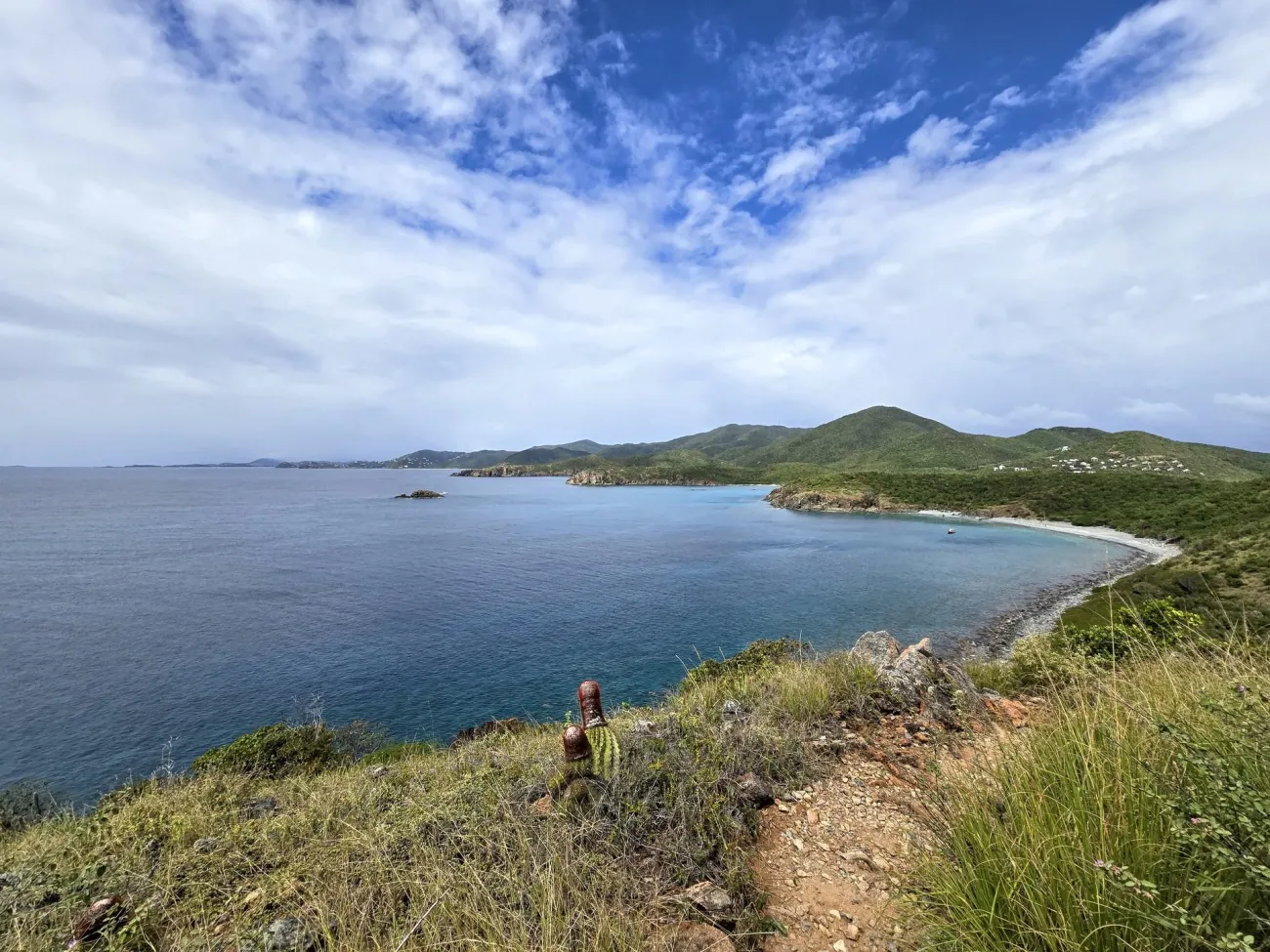
Photo: NPS · Public domain (U.S. Government work). Resized. No claim to original U.S. Government works.
The specific NPS trail description places Salt Pond Bay beach about a quarter mile from the parking area. Continuing from the beach to Ram Head adds a trail just under a mile in length, followed by the return. That distinction matters: the short stroll to the beach is not the whole Ram Head outing. The park's guided-hike description characterizes the complete route as just under two and a half miles.
Ram Head is exposed, with rocky ground and little dependable shade. Start with adequate water, sun protection and footwear that grips; the scenery is not a reason to approach an edge or continue when uncomfortable. Leave time to enjoy the view without turning the walk into a race against a pickup. If you add a swim, reassess your energy, water and the day's conditions before starting back. A sunset photograph also creates a darker return, so plan lighting, footing and transport beforehand. Treat a wet or washed-out access track as a reason to change the plan, not as an invitation to find an unofficial shortcut through vegetation.
Reef Bay: plan a substantial day, not an easy loop
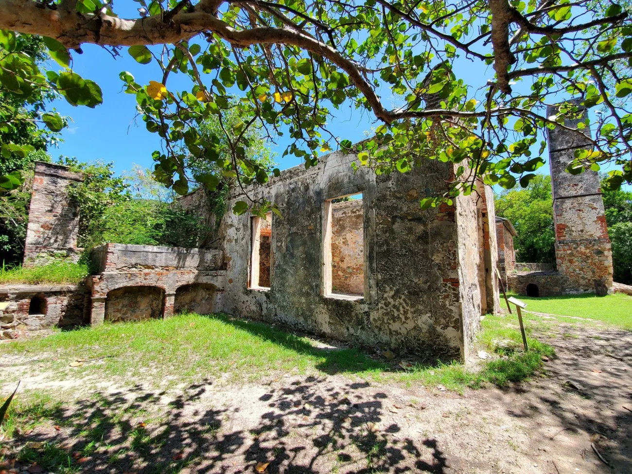
Photo: NPS/Parnicza · Public domain (U.S. Government work). Resized. No claim to original U.S. Government works.
Reef Bay's NPS description gives about three miles one way to the beach when including the waterfall and petroglyph visit. A self-guided return therefore means roughly six miles, with about 900 feet of climbing back out. The trail is steep, rocky and uneven. It is a very different commitment from stopping at a roadside overlook, even though much of the outward route descends through shade.
The walk links large trees, estate remains, a sacred Indigenous petroglyph site and the sugar factory near the shore. Waterfall flow depends on recent rainfall; do not make it the condition for a worthwhile visit. Keep hands off carvings and fragile structures, and read the history rather than treating ruins as climbing props. A ranger-led outing may have a particular transport arrangement, but a boat return should never be assumed for an independent walk. Confirm exactly what the booking includes. The official page contains differing descent-time estimates, so it is more useful to allow a substantial day than to promise one universal duration. Carry food and water for the return, and turn around while you still have a comfortable reserve.
Coastal parks need a water and footing check
Some protected places are visited partly by walking and partly by boat or swimming. At The Baths on Virgin Gorda, National Parks Trust visitor guidance describes steps and handrails through the boulders, and warns that winter swell can prevent sea access. This is a passage requiring balance, bending and sometimes wading, not simply a flat promenade between beaches. Ask about current conditions and the actual route if anyone has mobility concerns.
On St. Croix, a Buck Island excursion is mainly a boat-and-water experience, with any island walk subordinate to the operator's plan and the conditions. Choose an NPS-authorized concessioner rather than assuming a generic boat ticket includes the underwater trail. Sandy Point is a wildlife refuge with seasonal public closures, not an always-available extension to a coastal drive. The Fish and Wildlife Service describes a closure roughly from mid-April through August for nesting turtles. Keep an alternative on the same island, and respect a closed gate even if an old itinerary says the beach should be open.
Water, plants and communication deserve space in your bag
The NPS hiking guidance warns that many trails have little or no mobile service. Download the route, tell somebody where you are going and agree a return check-in. Carry drinking water, food, a hat, appropriate footwear and a means of keeping essential items dry. Do not rely on finding a shop at the beach at the end of a trail. A small first-aid kit is useful, but it does not compensate for a route beyond your fitness or comfort.
Stay on the trail and avoid handling unfamiliar plants or fruit. The park's safety advice highlights manchineel and Christmas bush, alongside heat, sharp marine life and unstable historic walls. A tree's shade does not establish that its sap or fruit is harmless. If weather deteriorates, shorten the outing while returning is still straightforward. Do not use a bay's inviting appearance as proof that swimming is safe after the hike: check flags and conditions independently. When a companion is struggling, stop to reassess rather than treating completion of the original route as compulsory.
Leave the day enough time to work
Confirm how you will reach and leave the trailhead. A driver dropping you at one end does not automatically agree to collect you at another, and a trailhead is not necessarily a safe place to wait after dark. Keep the pickup location, driver's contact and a realistic time window in your notes. If a walk is part of a ferry day trip, work backwards from the return departure and keep a generous margin. Choosing a shorter trail is better than having to hurry over loose ground.
Leave historic material, shells and plants where they belong; leave no food for wildlife. Keep voices low where others are watching birds or reading a memorial or sacred site. On a guided walk, follow the guide's group limits and do not press for a swim or shortcut they judge unsuitable. A park fee contributes to managed access; it is not permission to ignore restrictions. Back at the accommodation, separate the walks you actually completed from photographs taken at nearby viewpoints. The Virgin Islands offer enough variety that one well-chosen outing can be a satisfying part of the trip without converting every day into a hiking challenge.
Frequently asked questions
Is Reef Bay a short walk?
No. The full route to the beach with the petroglyph visit is about three miles each way, with a steep return climb. A specifically booked guided outing can have different transport arrangements; independent walkers should plan for the climb back.
How far is Ram Head from the parking area?
The short path to Salt Pond Bay beach is only the first leg. The headland continuation and return bring the complete outing to roughly two and a half miles; source distances depend on the exact endpoints.
Are there accessible walks on St. John?
NPS identifies facilities at Cinnamon Bay, Francis Bay and Annaberg. Check current surfaces and ramps directly with the park, since storms and swell can make beach access unusable.
Can I walk through The Baths in ordinary beach sandals?
The boulder passage involves steps, balance, bending and potentially water. Choose footwear suited to the actual route and follow current park advice; it is not a flat, universally accessible beach path.
Can I rely on my phone for a remote trail?
No. Download a map and keep a return plan with someone else. NPS warns of limited or absent reception on many trails; use a route and conditions appropriate to your party.
Last updated: