EGYPT · CAIRO GUIDE
Modern Cairo Photos: Nile, Gezira & the Urban Skyline
Modern Cairo photography is about the city’s river, islands, bridges and inhabited skyline. It offers a different visual story from the pyramids and medieval monuments. Choose an authorised riverside or public viewing position and make the river’s relationship with the surrounding buildings the centre of the plan.
Let the Nile Organise the Frame
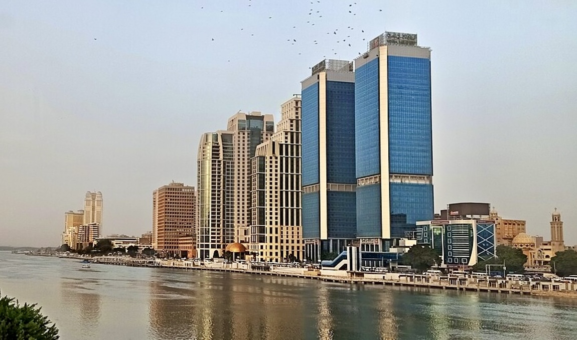
Start with the river as a line through the city. Decide whether a bend, a bridge or a recognisable island building should anchor the photograph, then simplify the surrounding edges. From higher permitted viewpoints, foreground roofs can explain the scale; from street level, reflections and the opposite bank may tell a more intimate story. Neither requires claiming an unnamed rooftop as a public attraction.
Gezira includes the Opera House area and Zamalek, but the island is not one undifferentiated neighbourhood. The Cairo Governorate’s Zamalek page provides location context. A photograph’s exact buildings and viewing direction should be identified from its documented source, not guessed from the title Modern Cairo.
Choose the Picture for the Available Visibility
A hazy afternoon may make distant towers disappear while leaving a strong river foreground. Work with the nearer layers instead of assuming every skyline day will have clear long-distance views. For an evening photograph, look at the balance between remaining sky light and illuminated buildings; the result depends on weather, viewpoint and the actual access window.
If photographing through glazing, reflections may become more visible as the surroundings darken. Try a permitted position away from bright interior light without pressing equipment against the glass or blocking other visitors. Review the main building edges before leaving. A steady, unobstructive handheld picture is a better choice than setting up support where it is not allowed.
Plan the Return as Carefully as the View
City photography can cover less ground than the map suggests. Pick one stretch of river or one viewing visit, then add a nearby meal or cultural stop rather than repeatedly crossing the metropolitan area. Use Map & Neighbourhoods to understand the geography and verify the actual entrance and return transport before an evening outing.
Do not photograph security facilities, officials or sensitive infrastructure simply because they are included in a city panorama. Follow local restrictions and staff directions. A ferry or boat is a separate service with its own arrangements; a photograph of boats on the river does not establish a public boarding point. For another architectural approach, compare the Ibn Tulun photo guide.
Frequently Asked Questions
Does Modern Cairo mean New Cairo?
No. Here it describes contemporary metropolitan and Nile-side cityscapes. New Cairo is a particular eastern urban area and should not label every modern skyline photograph.
Can I expect the same skyline as an older photograph?
Buildings, signage, haze and lighting change. Treat a credited earlier photograph as a visual reference, not a current guarantee of an identical view.
Do I need a rooftop or tripod?
No. Choose a lawful accessible viewpoint and follow its equipment rules. Do not assume private roofs, bridge positions or camera supports are available to visitors.