
Sign in
For Photos4Travel editors and team members.
Peru · Walking & National Parks
Hiking in Peru: Inca Trail, Huaraz, Colca and Amazon Walks
Choose a Peru walk by its altitude and return climb as well as its distance. A short path can finish above 4,400m, while a canyon outing can begin with an easy-looking descent and save the hardest work for the way home. In the Amazon, the elevation gain may be modest but heat, mud and the boat transfer determine the day. The right choice is the walk you can enjoy with time left to return safely.
For a first mountain visit, build in quiet days before the demanding route. Use a qualified operator, ask for the exact trailhead and turnaround time, and make sure your insurance covers the altitude and activity you are buying. The figures below are planning profiles, not a surveyed navigation file: one-way distances, return distances and elevation differences are identified separately.
Compare the walking days before choosing a tour
On small screens, swipe horizontally to read the whole table.
| Walk and start | Distance and walking time | Climbing and conditions | Planning fit |
|---|---|---|---|
| Laguna 69, Cebollapampa | 7km one way; about 14km return. Allow roughly 5–7 hours walking and stops | Lake 4,604m; approximately 750m net height difference from the usual trailhead, with additional undulations | Strenuous high-altitude day after acclimatization |
| Laguna Churup, Pitec control | 3.15km one way; about 6.3km return. Allow 5–6 hours including pauses | Lake about 4,450m; sustained ascent and rocky upper terrain; cumulative gain depends on approach | Shorter distance, substantial effort and awkward wet-rock sections |
| Sangalle direct path, Cabanaconde | Official inventory gives 4.5km down; about 9km out and back. Prefer an overnight; allow 2–3 hours down and 3–4 hours up | Published profiles indicate roughly 1,300–1,400m descent/climb; check the actual start and lodge elevation | Hard canyon walking; the return climb is the main commitment |
| Achachiwa viewpoint, Cabanaconde | About 1km each way from town; allow 45–60 minutes with viewing time | Highland village approach, without descending to the canyon floor | Shorter alternative when a canyon trek is unsuitable |
| Lake Sandoval, reserve landing | 3km one way after the boat; about 6km return walking, with canoe/viewing time additional | Lowland trail; mud, humidity and heat replace mountain climbing as the main difficulties | Guided half-day or full-day nature outing |
| Classic Inca Trail, Km 82 area | About 43km over 4 days/3 nights; daily stages depend on assigned camps | High passes, long stone staircases and camping; not a succession of gentle strolls | A permit-led trek that shapes the whole itinerary |
Distance figures come from the official route descriptions linked below. Return lengths are arithmetic estimates for returning on the same approach; walking-time ranges include editorial allowance for the return and pauses. Net elevation difference is not cumulative ascent. Conditions and your acclimatization can make the same walk take considerably longer.
Laguna 69: a full mountain day from Cebollapampa
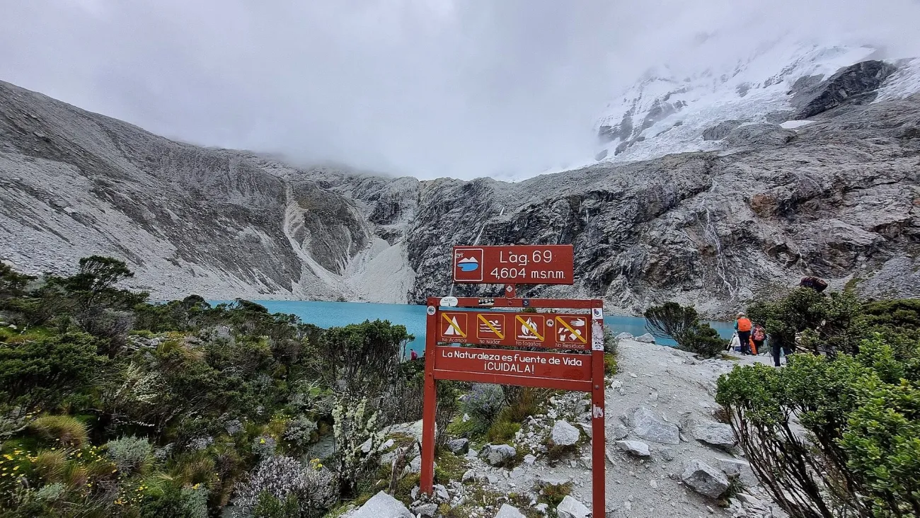

The walking start is Cebollapampa, reached through the Llanganuco sector rather than from Huaraz town on foot. The Ministry of Tourism inventory lists the lake at 4,604m and the uphill path as 7km and about three hours one way. That makes the return a substantial day before the road journey back is counted. Do not mistake “one-day tour” for three hours of total walking.
The usual trailhead is around 3,850m, as described by a local operator’s route profile. The resulting height difference is roughly 750m; it is not a GPS measurement of cumulative ascent. Ask your guide where the transport drops you and how much time the group allows for the climb, lunch and return.
Give the hike its own day and keep the evening uncomplicated. Carry warm and waterproof layers even if the valley is sunny, plus food, drinking water and a headlamp. If you develop a worsening headache, nausea or unusual exhaustion, discuss turning back rather than pushing on to justify the early start. The lake will not be enjoyable if the return becomes an endurance problem.
The current Huascarán National Park visitor page requires authorized operators and lists park-entry tariffs. Confirm that your excursion includes the correct ticket and current access. A mountain summit advertised alongside the lake is a separate activity, with different skills, equipment and insurance requirements.
Laguna Churup: shorter does not mean easier
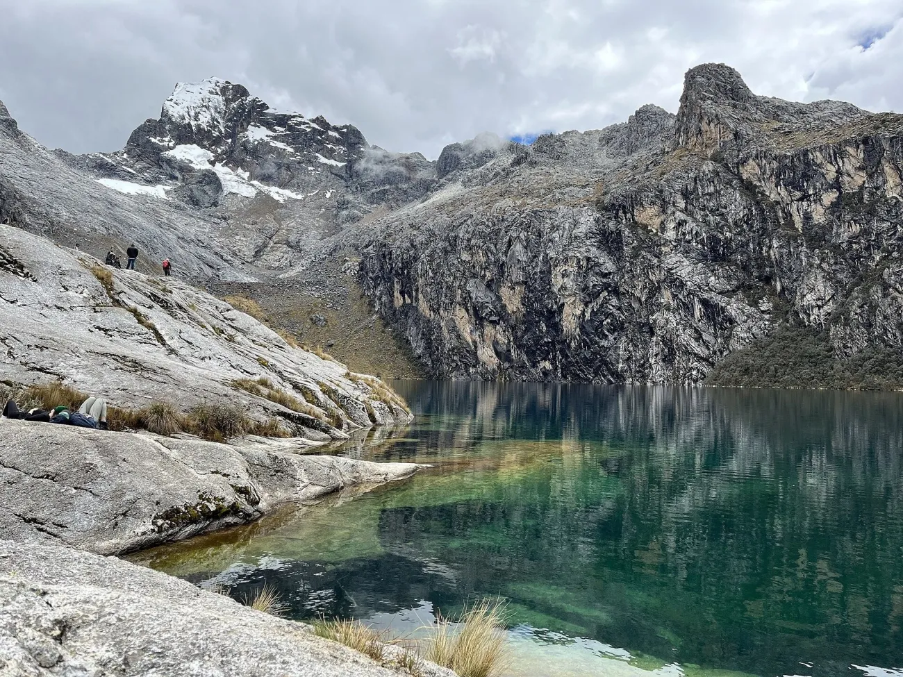

Begin at the Pitec park-control approach. The official Churup inventory gives 3.15km to the lake and describes rocky access near the top, with an alternative approach on the other side of the stream. The lake is about 4,450m high. The appeal is a compact route into a steep mountain setting; the mistake is to judge the outing only by its mileage.
Before departure, ask the guide which upper approach is appropriate that day. Wet rock, frozen patches and a dislike of exposed or hands-on sections can change the decision. Turning around below the final rocks is a valid outcome. Do not add the higher Churupita extension simply because the group arrives early; consider energy, daylight and the forecast first.
Arrange the return transport before starting. PromPerú’s visitor information describes payment at the control and notes that electronic payment depends on connectivity. Carry a practical cash backup rather than depending entirely on a phone signal at the trailhead.
Colca: Sangalle overnight or a viewpoint walk?
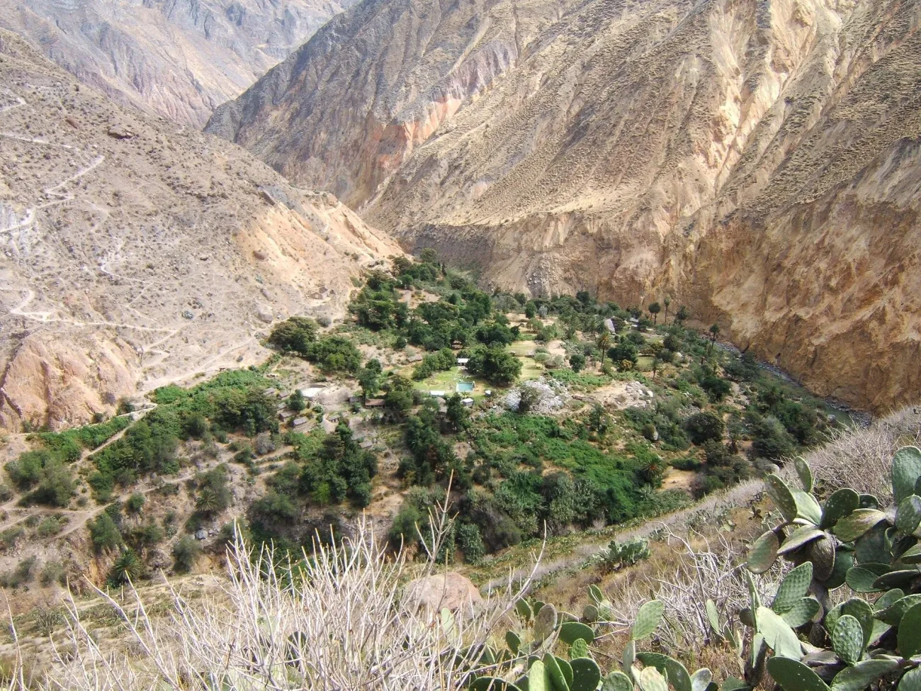

Cabanaconde is the starting base for the direct descent to Sangalle. From the main square, the traditional approach follows Calle Grau toward the signed trail and Cejana viewpoint before descending. The local Pachamama trekking notes describe this start and the demanding climb out; use them for orientation, then obtain a current local briefing and guide.
The official Sangalle inventory lists 4.5km from Cabanaconde and a roughly two-to-three-hour descent. Published starting elevations and trail profiles vary, so plan for a major climb of roughly 1,300m or more rather than treating any single ascent number as a survey. Confirm the precise lodge and route. An overnight lets you split the descent and ascent, although it does not remove the effort.
Start the climb early, agree the guide’s turnaround and water plan, and do not count on a mule being available as an emergency solution. Carry your own water and check what the lodge can supply. A hot afternoon at the canyon floor feels very different from the high road used to reach Colca.
If that climb is unsuitable, stay above the canyon. PromPerú’s Colca guide places Achachiwa viewpoint about 1km west of Cabanaconde. Combine the short walk with village time or a vehicle excursion to Cruz del Cóndor. Achachiwa gives you canyon scenery without the descent and climb out of Sangalle. Confirm the tourist-ticket rules with AUTOCOLCA for your visit.
Inca Trail: choose the operator before the hotel sequence
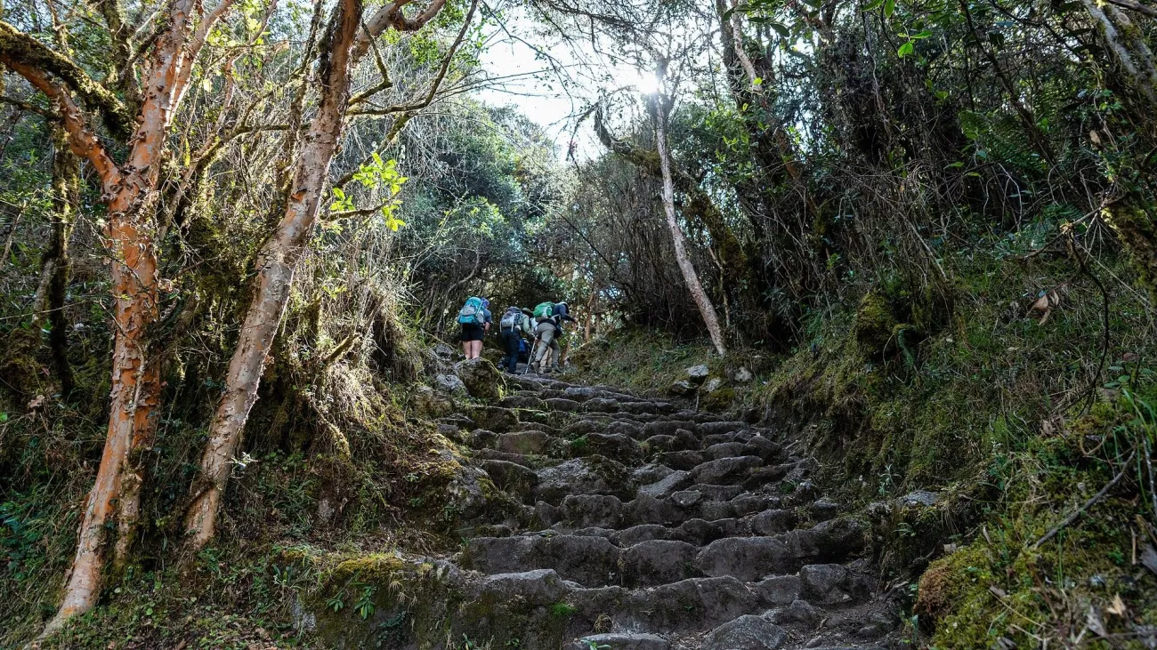

PromPerú distinguishes the classic 43km, four-day itinerary from the shorter 12km option. The classic trek requires repeated climbs, stone steps and several nights in camp. The short version avoids the full multi-day profile but is still a walking day at altitude; ask how much climbing its specific itinerary contains.
Registered agencies buy named, paid permits through TuBoleto under the September 2026 rules. Obtain confirmation before committing the rest of the trip. Compare the porter arrangements, carried load, tent and sleeping equipment, meal provision, emergency communications and return transport. A cheap headline price is difficult to evaluate until those inclusions are clear.
Allow acclimatization before the trail, and tell the operator about relevant health or mobility concerns. February maintenance affects the trail network; it does not mean the archaeological site has a routine month-long closure. The official 2026 reopening notice is a dated example, while your operator must confirm access for the departure you are buying.
Tambopata: Lake Sandoval and lodge-based forest walks
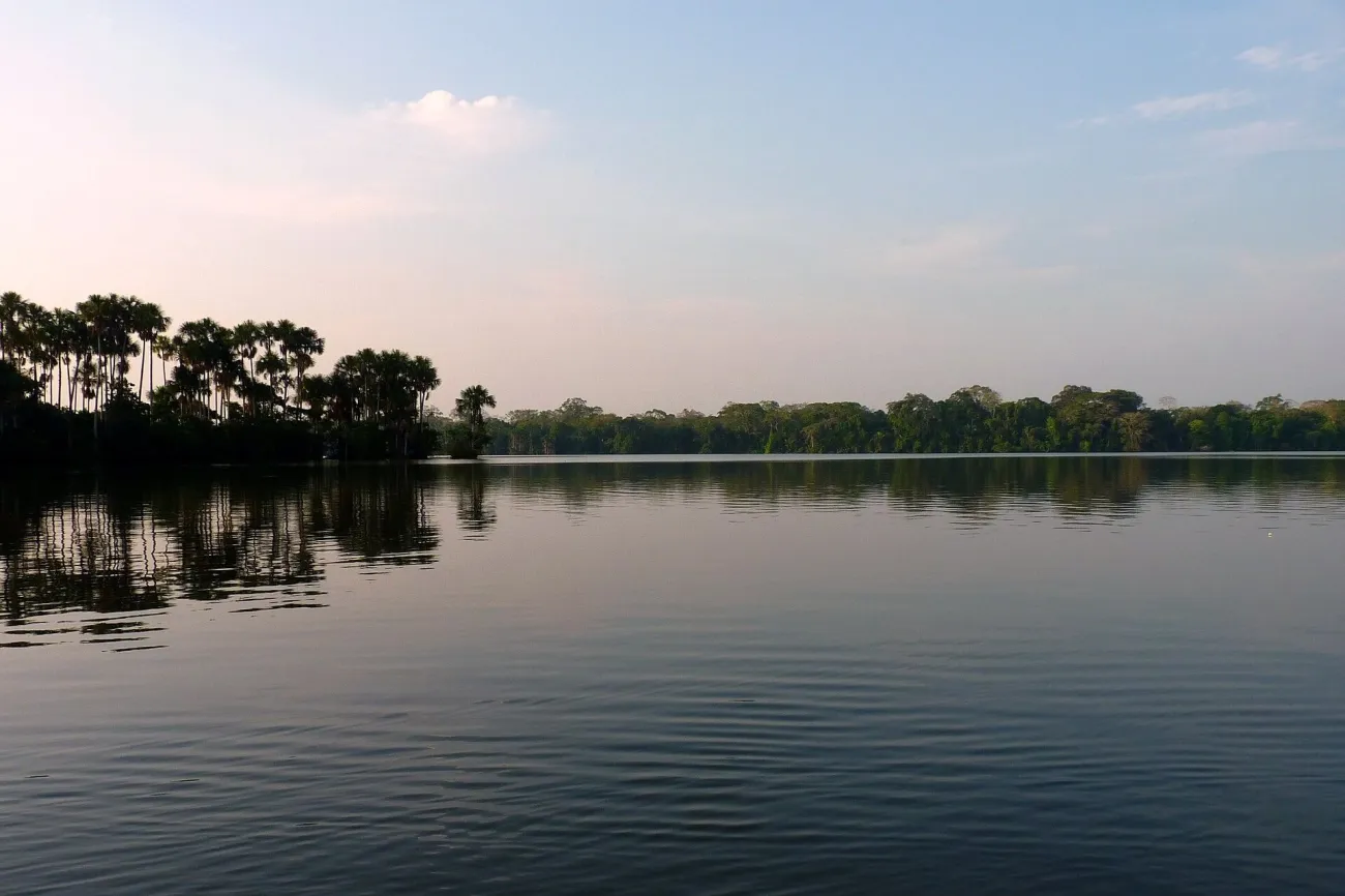

From Puerto Maldonado, the Sandoval outing begins with a river journey, then a forest path to the lake. SERNANP describes about thirty minutes by river followed by 3km walking, with half-day or full-day visits and authorized operators. Boat travel, wildlife stops and canoe time are additional to the walking distance.
Ask whether the path is muddy or flooded, which footwear is supplied and whether the boat has suitable lifejackets. Keep a dry bag for camera and documents. Walk quietly and allow the guide to set the pace; the point is to notice movement and sounds, not to complete a distance quickly. Giant otters, monkeys or macaws may be possible sightings, but a responsible itinerary never promises a particular animal.
Choose a lodge by its actual sector. A Sandoval visit, an upper-Tambopata clay lick and a lodge close to Puerto Maldonado involve different transfers and daily plans. Three lodge nights generally give more room for weather changes than one rushed night. Manu is a different destination with its own access and permit arrangements; it should not be sold as a casual alternative walk from the same hotel.
Decisions to make before every walking day
Confirm the forecast and current route opening, the group’s planned pace, the last safe turnaround and who carries emergency equipment. Tell your accommodation where you are going. Pack for a delayed return, and make sure the chosen guide knows about any relevant condition before leaving the road. Mobile coverage is useful when present; it is not a rescue plan.
The CDC’s altitude guidance emphasizes gradual acclimatization and avoiding further ascent when ill. Fitness does not remove susceptibility. If you cannot fit acclimatization into the itinerary, choose a lower, shorter outing rather than trying to solve the problem with a faster start or a strong cup of coca tea.
Walking and national park questions
Is Laguna 69 suitable on my first day in Huaraz?
It is a poor default. The lake is at 4,604m and the usual return walk is about 14km. Allow gradual acclimatization and assess how you feel before attempting it; a tour booking does not establish medical suitability.
Can I visit Huascarán National Park independently?
The current SERNANP visitor page requires authorized operators. Use its operator information and confirm the current procedure for the exact route you want. Do not rely on older blog instructions describing unregulated entry.
Is a Colca viewpoint tour the same as a canyon trek?
No. A viewpoint excursion can remain on the valley roads and upper rim. A Sangalle trek descends into the canyon and requires a substantial climb out, with separate walking, accommodation and water arrangements.
Does a short Amazon walk need special preparation?
Yes. Check heat, rain, mud, boat transport and insect protection. Use an authorized operator for reserve access, carry water and protect documents and electronics. Low altitude does not make every forest path easy.
Can I buy an Inca Trail permit myself?
The current system uses registered agencies to buy named permits for their clients. Choose the operator, confirm the actual paid permit and included Machu Picchu visit, then arrange the rest of the itinerary around it.
Last updated: