
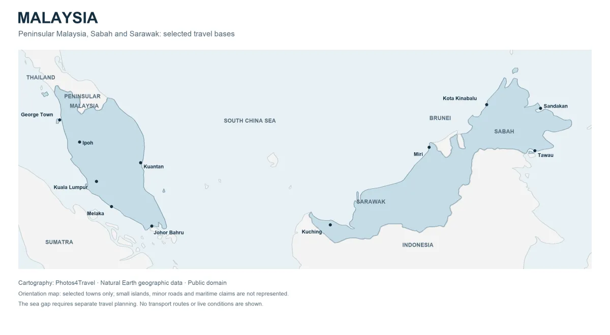
Malaysia has two major land areas separated by the South China Sea. This orientation map shows Peninsular Malaysia to the west and the Malaysian states of Sarawak and Sabah on Borneo to the east. It uses Natural Earth geographic data and selected settlement coordinates. It is designed to explain travel geography, not to provide turn-by-turn directions, live ferry routes or a legal statement of maritime boundaries.
Small islands and minor settlements are simplified at this national scale. In particular, the map should not be used to choose a precise beach landing, park trailhead or accommodation entrance. Open the full-size version to read town labels, then use an operator’s directions and a detailed local map for the last stage of a journey.
| Area | Useful gateway | Do not assume |
|---|---|---|
| Western peninsula | Kuala Lumpur, Butterworth/Penang | A train arrives on Penang Island |
| Eastern peninsula | The gateway for the chosen island | Every boat leaves from one port |
| Sarawak | Kuching or a flight plan for Mulu | Mulu is a Kuching day trip |
| Sabah | Kota Kinabalu, Sandakan or Tawau | One airport serves every activity |
Swipe or scroll the table sideways if needed.
The western peninsula corridor
Kuala Lumpur sits inland on the western side of Peninsular Malaysia. North of the capital, Ipoh and the Penang area form a practical sequence for visitors using the main rail corridor. Butterworth, the railway gateway to Penang, is on the mainland; George Town is across the strait on Penang Island. That distinction explains why a “train to Penang” still leaves a crossing and local transfer.
Langkawi lies farther northwest, off Kedah, and is a separate island destination rather than a continuation of George Town’s local transport. Check the operating airport or mainland ferry port for your exact dates. Do not draw a direct line between two islands on a national map and assume a passenger service follows it.
The western corridor is an efficient introduction for travellers who prefer cities, food and shorter changes of base. It also allows a simpler return to Kuala Lumpur if international flights are booked there. An open-jaw itinerary can reduce backtracking, but its value depends on actual flights and luggage costs.
Melaka and the southern peninsula
Melaka is south of Kuala Lumpur, so it runs against the direction of a Kuala Lumpur–Ipoh–Penang trip. It can work as a separate overnight outing before travelling north, or as a stop on a southern road or coach journey. Historic streets around the river are the visitor focus; a transport terminal outside the centre is not the end of the trip.
Johor Bahru lies near Singapore at the southern tip. It is useful for travellers deliberately crossing that border or visiting attractions in the Johor area. Border queues, onward connections and the exact checkpoint can matter more than the apparently short straight-line distance between the two urban areas.
Do not confuse the peninsula’s tip with access to East Malaysia. There is no domestic road crossing from Johor to Sabah or Sarawak. A map showing the entire federation in one frame can hide the practical scale of the sea gap.
The east coast and island gateways
Kelantan, Terengganu and Pahang face the South China Sea on the east side of the peninsula. Their island gateways are not interchangeable. The Perhentians, Redang and Tioman each require a plan tied to the correct port, transfer provider and accommodation landing. A flight to a nearby mainland airport is only one part of that journey.
Kota Bharu is a northern east-coast gateway, while Kuantan sits farther south. These towns can also be destinations in their own right for markets, food and regional culture. A traveller seeking a beach should decide whether they want a mainland base with road access or an island with boat dependence.
The Titiwangsa range separates much of the peninsula’s western and eastern interior. Mountain roads and indirect connections mean crossing the country takes longer than the map suggests. Avoid combining a highland outing and an east-coast boat departure simply because the points look close on a screen.
Highlands and inland forests
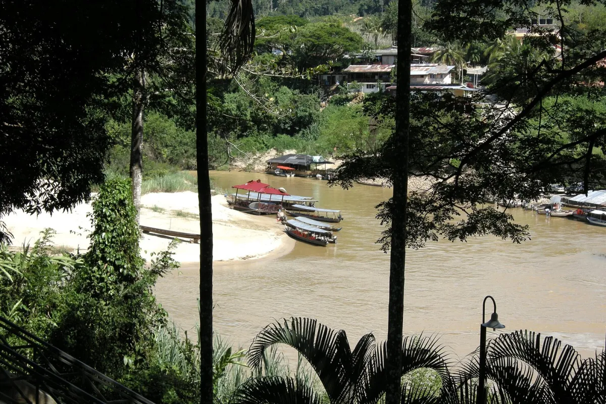
The Cameron Highlands are an inland mountain area rather than a railway stop in the main town. The route into the hills, accommodation location and local travel between tea estates require road planning. Lower temperatures do not remove the possibility of rain, muddy ground or traffic delays on narrow access roads.
Taman Negara spans parts of Pahang, Kelantan and Terengganu. Kuala Tahan is a commonly used visitor gateway, but the national park is much larger than that village. Choose a trail or guided activity by the relevant entrance, not merely by the park name in a hotel search.
Inland forest experiences also differ from town sightseeing. A short marked walk, a river excursion and a multi-day mountain trek have separate physical requirements, equipment needs and permissions. This map deliberately does not connect them with invented paths or imply that public transport reaches every access point.
Sarawak: Kuching, Miri and Mulu
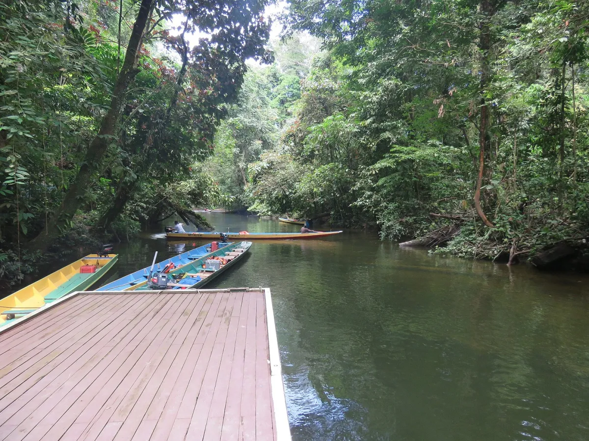
Kuching is in southwestern Sarawak and works as a city base for nearby outings. Miri lies much farther northeast. Gunung Mulu National Park is an additional destination with its own flight and accommodation planning; it is not a convenient afternoon detour from Kuching.
Distances within Sarawak are substantial, even where towns share the same state. Check whether a suggested journey is actually a flight, a long road transfer or a route dependent on another transport stage. A short map label cannot communicate the time required to reach an interior lodge.
Brunei is a separate country on the northern coast of Borneo. Some overland routes may involve international borders. Confirm the precise route, passport requirements and vehicle arrangements with the operator rather than assuming that all travel between two Malaysian towns is entirely domestic.
Sabah: west coast and wildlife gateways
Kota Kinabalu is on Sabah’s west coast. It is convenient for city stays and planning access to the Kinabalu area, but a summit climb requires advance arrangements and cannot be substituted by simply booking a room in the city. Mountain weather and park rules determine what is possible.
Sandakan is on the eastern side of the state and provides access to the Sepilok area and onward arrangements for some river lodges. Tawau is farther southeast and is used for trips toward Semporna. These are different gateways with different transfer times; compare the final destination before choosing an airport.
Offshore eastern Sabah requires particular attention to current official travel advice and insurance cover. The national orientation map does not show advisory zones. Consult the current advisory map issued by your own government and ask the operator to identify the location of every island or dive site included in a package.
Turn the map into a workable route
Begin with your arrival and departure airports, then mark overnight bases. Join only the bases you can connect with real services. A northbound peninsula trip usually wastes less time than repeated returns to Kuala Lumpur, while a focused Sarawak or Sabah route can be more rewarding than several short flights across Borneo.
Count transfer days explicitly. An airport departure, boat crossing or long coach ride can consume the useful part of a day even when the vehicle journey sounds short. Leave a mainland or city buffer before an important international flight if the preceding stay depends on sea conditions.
Finally, download detailed maps before leaving a good connection and save the accommodation’s local contact. Match the spelling and address, especially where a property uses a marketing name different from the village. Keep a written meeting point for drivers and boats, because an approximate pin may place you on the wrong side of a river or at a closed entrance.
Use the Where to Stay comparisons to choose the base behind each map label.
Travel Tip:
Use this map for regional orientation, then confirm the actual gateway, landing and hotel approach with the operator.
Planning sources
Use the current authority or operator information for details that can change.
- Natural Earth geographic data and terms
- KTMB current train timetables
- UK official Malaysia safety advice
Frequently Asked Questions
Does the map show current ferry or rail routes?
No. It is a geographic orientation map using Natural Earth data. Confirm actual services through operators and use a detailed local map for the final approach.
Can I drive from Kuala Lumpur to Sabah?
There is no domestic road connection across the South China Sea. Plan the peninsula and Borneo as separate transport blocks and keep passport and entry evidence available.
Why is Butterworth different from George Town?
Butterworth is the mainland rail gateway, while George Town is on Penang Island. Include the crossing and local hotel transfer when planning a train arrival.