
Sign in
For Photos4Travel editors and team members.
Dominican Republic · Walking & National Parks
Dominican Republic Hiking & National Parks
Walking in the Dominican Republic can mean a short waterfall approach, a guided cave visit or several days in the high mountains. Those outings need different preparation. Choose a route you can complete comfortably, then check current access, weather and the arrangements for getting back.
This guide separates Pico Duarte trekking from shorter nature outings around Jarabacoa, Samaná, Bayahibe and Puerto Plata. It does not treat a park name as permission to explore everywhere independently. For any guided product, obtain the actual start, finish, distance, expected duration and physical requirements before booking.
Choose the route format before choosing a photograph
Swipe or scroll sideways to compare the full table.
| Outing | Format | Start and return to establish | Main preparation |
|---|---|---|---|
| Pico Duarte | Guided multiday trek with camping | La Ciénaga approach or another specifically booked route | Fitness, cold-night kit and complete logistics |
| Jarabacoa waterfalls | A particular trail or managed visit | Named attraction entrance and same pickup point | Footing, steps and current water conditions |
| El Limón | Guided walking or mixed horseback/walking outing | The chosen trailhead, not just the waterfall name | Mud, steps and return transport |
| Los Haitises | Boat outing with authorized landings or guided trail | Actual pier and landing itinerary | Boarding, slippery paths and conservation rules |
| Cotubanamá mainland | Marked trails, caves and springs | Authorized entrance and agreed route from Bayahibe | Guide, cave access and suitable footwear |
| Damajagua | Approach walk and guided waterfall descent | Park meeting point and route-specific return | Swimming suitability and supplied safety equipment |
Pico Duarte: organize a complete mountain trek
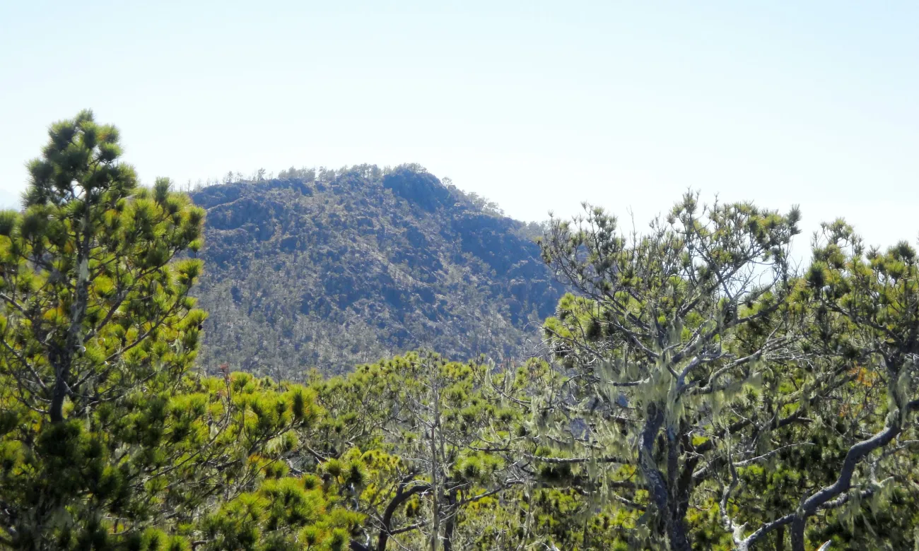
Photo: jvg19 · Pinus occidentalis on Pico Duarte.jpg · CC BY 3.0. Brightened slightly and excess sky cropped from original. Resized.
Pico Duarte is a substantial change from a beach itinerary. The official tourism description identifies a commonly used approach through Manabao and La Ciénaga toward Compartición and the summit area, with official camping at Compartición or Valle de Lilís. Its two- or three-day examples describe particular routes, not a universal schedule for every hiker.
For a first visit, arrange the whole journey with an established guide or operator: transport to the trailhead, park entry, guide, camp, meals, drinking-water arrangements and pack support if used. Obtain a written day-by-day itinerary showing sleeping places and the return. If you enter and leave through La Ciénaga, confirm the same-trailhead collection; an alternative exit requires different transport.
Ask for the real walking distance and ascent for each day, the expected hours at your pace and what happens if someone cannot continue. A package's number of days alone tells you little about the difficulty of its longest stage. Allow time in Jarabacoa or the approach area before the start instead of depending on a late flight to connect straight into the trek.
Nights are cold compared with the coast. Discuss sleeping equipment, warm layers, rain protection and footwear with the operator, and check what the price supplies. You need adequate fitness and endurance; being comfortable on a beach walk is a different preparation. Follow the guide's decision if weather or access makes the summit inappropriate.
Keep the departure after the trek flexible enough for delays. Do not schedule a distant international flight immediately after the advertised finish. Check that insurance covers the activity and location you intend to undertake, including any limits relevant to trekking and emergency assistance.
Jarabacoa waterfalls: choose one defined outing
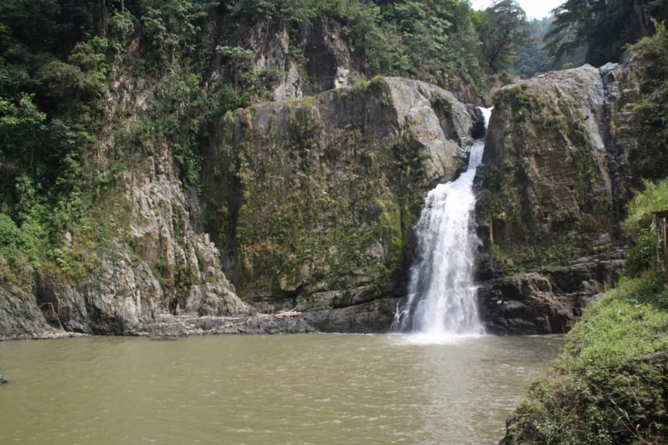
Photo: Jos1950 · Salto Jimenoa 300.jpg · CC BY-SA 4.0.
The Jarabacoa guide names Baiguate and Jimenoa among the area's waterfalls. Use those names to investigate specific visits, not as evidence of a single trail joining them. Different entrances, steps, bridges and access arrangements can change what a trip involves.
Before leaving town, establish which waterfall and entrance you will use, whether a guide accompanies you, how much you walk and where the vehicle waits. An operator should be able to explain the route in practical terms: ground surface, steep sections, exposed areas, toilets and any option to turn back.
Choose secure footwear and carry water even for a shorter outing. A swimming photograph does not establish safe access to a pool on your date. River levels and rain upstream matter; accept local restrictions and keep children close on slippery ground. If the route does not suit the group, choose a viewpoint or another lower-demand visit rather than continuing because you have already arrived.
El Limón: confirm the trailhead and walking component
El Limón is an established Samaná nature outing, but products can use different approaches. Ask for the exact starting point and the return arrangement. “Visit the waterfall” does not explain the amount of walking, stairs, mud or time needed.
For a walking visit, ask whether you return on the same route and whether the pace suits your group. For a horseback product, establish the condition and suitability of the animals, rider requirements and what you still do on foot. Riding part of the approach does not automatically make the final visit accessible.
Carry what you need in a small secured bag and protect your phone from rain and spray. Follow the guide about where to stand and whether water access is appropriate. Leave enough time for the return before your driver or onward transport is due.
Los Haitises: distinguish a boat visit from a hiking route
A visit to Los Haitises often combines boats, mangroves and cave landings. That is a different day from an extended rainforest walk. Check the actual product so that everyone understands how much time is afloat and how much is on foot.
Ask about boarding, steps at landings, cave footing and whether a particular stop can be skipped. A walking aid or difficulty with wet steps should be discussed before reaching the pier. Keep to authorized paths and protect the cave art by looking without touching. Boats should keep clear of sensitive bird areas.
Cotubanamá: explore the mainland with clear access arrangements
Cotubanamá's mainland has marked trails, caves and springs accessible from the Bayahibe area. It offers a land-based alternative to spending another day on an island boat, but requires its own route and entry checks.
Ask which trail or cave the guide proposes, where the authorized entrance is and whether swimming or special equipment forms part of the visit. Do not enter a cave or freshwater space simply because a track or photograph suggests access. Consider heat, uneven limestone and the amount of shade when choosing the time and pace.
Keep this outing distinct from a Saona booking. The park's wide geographical scope does not mean a boat excursion includes its mainland trails. If both interest you, allow separate time and compare what each product actually covers.
Damajagua: the descent matters as much as the walk
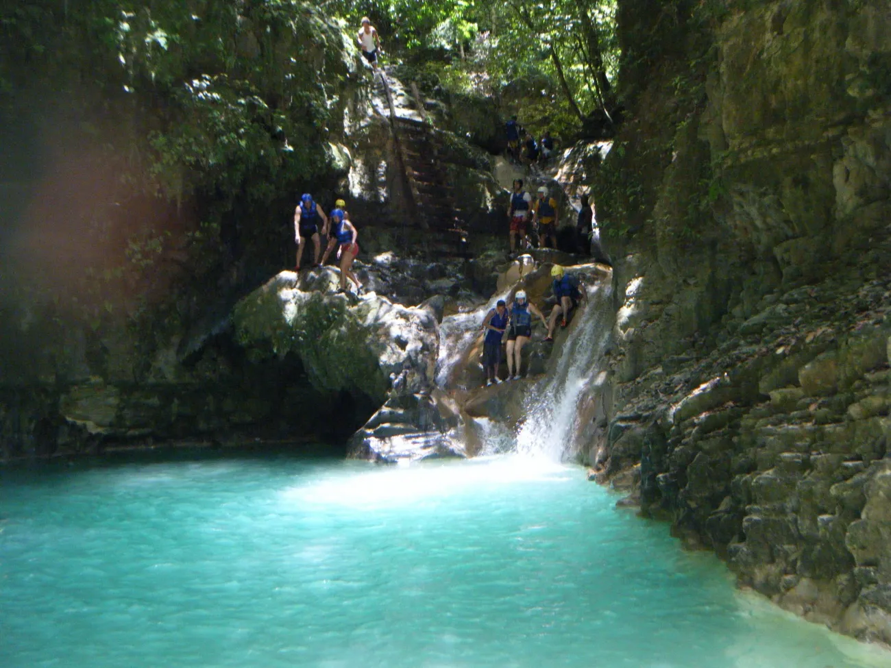
Photo: kikeam71 · 27 Charcas rio Damajagua - panoramio.jpg · CC BY-SA 3.0.
At Damajagua, the forest approach is only part of the activity. The guided descent involves water, slides or jumps according to the route. Confirm swimming requirements, the available section and whether particular obstacles can be bypassed.
Ask about minimum ages, footwear, flotation equipment, helmets and secure storage. The attraction's name does not guarantee that all 27 falls are available or appropriate. Tell the guide about a concern before starting, when there is still a straightforward choice of route or alternative plan.
Check weather, access and your return every time
Read the forecast for the outing's area, not only the coast where you slept. The environment ministry's April 2026 preventive evacuation notice illustrates that mountain access can change with official alerts; it is not a claim that the park is closed now.
Take water, appropriate layers, sun protection and secure footwear, and establish how emergency help is requested. Save the meeting point and tell your accommodation your plan when traveling independently. For broader preparation, consult Health & Safety and Best Time to Visit.
Walking and park questions
Can I climb Pico Duarte as a casual day trip?
Plan it as a guided multiday trek with camping and complete logistics. Choose the itinerary according to fitness, pace and current park arrangements.
Do I need warm clothes in the mountains?
Yes, cold nights require a different kit from the coast. Ask the trek operator about appropriate layers and sleeping equipment for the route and season.
Is El Limón always the same walk?
No. Approaches and walking components vary by product. Confirm the trailhead, steps, footing and return before choosing.
Is Los Haitises mainly a hiking day?
Many visits emphasize a boat journey and cave landings. Choose a specifically described walking route if hiking is your priority.
Does a waterfall photograph mean I can swim there?
No. Current water conditions and local rules decide access. Follow the guide and any official restrictions on the day.
Last updated: