USA TRAVEL GUIDE
USA Map & Regions: Choose Where to Travel
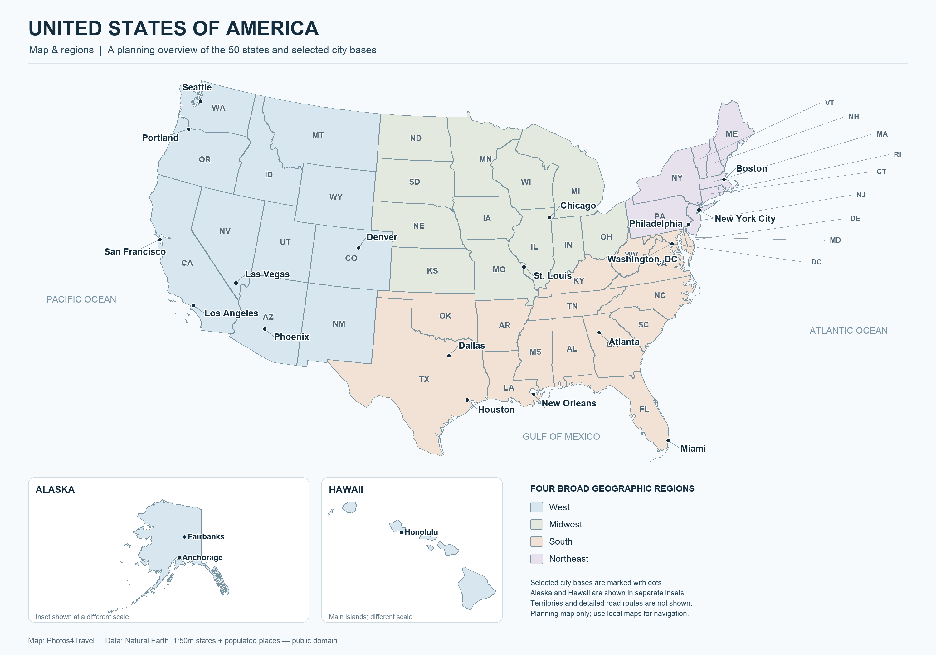
Open the full-size United States map
An American map is a starting point for choosing a trip, rather than a challenge to cover every region. Distances, mountains, coastlines and transport connections matter as much as state borders. Use the geographic map with the travel-region descriptions below to decide where your interests fit together. The groupings here are editorial planning areas; they are not presented as the four official Census Bureau statistical regions.
Swipe horizontally if needed to compare all columns.
| Planning area | Useful trip focus | Connection to examine |
|---|---|---|
| Northeast | Cities, museums and history | Rail corridor versus countryside additions |
| Southwest | Desert scenery and park routes | Elevation, access authority and overnight gateways |
| California and Pacific Northwest | Cities, coast and outdoor areas | Road conditions and separate city/nature bases |
| Alaska | One accessible excursion corridor | Seasonal rail, boat, road or air arrangements |
| Hawaii | One island or a proportionate island combination | Inter-island flights and the chosen coast |
How to read the map for travel planning
Start by locating your international gateway, your main overnight bases and the experience that matters most. Then look at the actual connection between them. A state boundary may be unimportant to a short drive, while a mountain range, water crossing or airport transfer can shape an entire day. Route planners can show distances, but a useful itinerary also needs time for stops, food and changes of plan.
Check how Alaska and Hawaii are shown. Insets make a national map readable, but their position on the page does not indicate the real journey from the mainland, and their scale may differ. The same caution applies to a diagram of rail routes: it shows connections, not necessarily frequent departures or equal travel times. Use a map for orientation and an operator or official road service for the details you can book.
The Northeast: cities, history and nearby countryside
The Boston–New York–Philadelphia–Washington corridor is a logical choice for a first trip focused on cities. It links major cultural centres and historic places with intercity trains. New England adds smaller towns, coast and inland scenery, but travelling beyond the main rail corridor changes the transport question. Decide whether those additions justify a car for part of the trip.
Do not treat New York City and New York State as the same scale of destination. A city stay can fill a holiday without exploring the wider state. Likewise, Washington is a city destination distinct from the surrounding region. Choose accommodation and day trips around the area you plan to explore rather than assuming a familiar place name means everything is nearby.
The Southeast: music cities, mountains and Atlantic coast
This planning area includes several different trip styles. Nashville and other music destinations suit a performance-led break; Appalachian areas appeal to walkers and scenic-road travellers; coastal cities and beaches offer a different pace. Pick a connecting theme and check the driving involved before placing all three into one week. The country’s cultural regions overlap, and their stories are richer than a single boundary on a map.
Florida deserves a separate route decision within a Southeast trip. Orlando’s theme parks, Miami’s urban and coastal setting and the Florida Keys have different accommodation and transport needs. A journey between them is a transfer to plan, not a brief hop between attractions. If beach time matters, leave days based near the beach rather than adding it to the end of an already long driving day.
Great Lakes and Midwest: city stays and water landscapes
Chicago can anchor a focused city trip with architecture, museums, food and a lakefront. The wider Great Lakes region adds smaller cities, shore towns and outdoor areas. Map the coast or lake you mean to visit: the lakes are substantial geographical features, and driving around one is not comparable to crossing a small inland lake district.
A Midwest trip can follow a cultural interest such as architecture, industrial heritage or regional food rather than imitate a western park itinerary. Add countryside when it fits the season and transport. For shorter holidays, one large city with a nearby second base often provides a clearer rhythm than a chain of widely separated cities linked by long drives.
The South and Texas: choose a specific corridor
New Orleans, the Mississippi River corridor and Texas can suggest tempting food-and-music combinations, but they should not be treated as one compact destination. Start with the city or landscape that interests you most and build a limited route around it. New Orleans rewards time on foot and attention to neighbourhood context; a broader road trip requires separate planning for each overnight stop.
Texas itself contains major metropolitan areas, Gulf coast and inland landscapes. Select among these before collecting accommodation options. A trip built around Austin and San Antonio differs from one focused on Houston or the state’s western outdoors. The map helps reveal when a domestic flight or a second future trip is a more sensible choice than a long return drive.
The Southwest: desert landscapes and layered jurisdictions
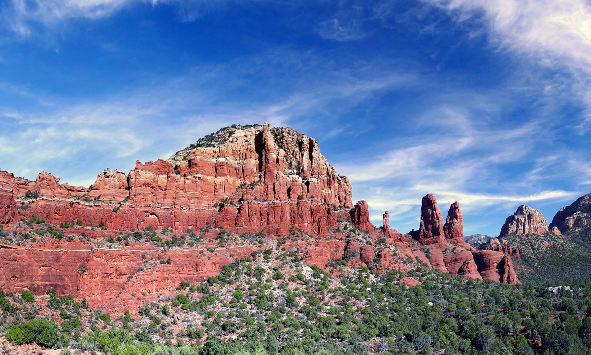
Southern Utah, northern Arizona and neighbouring Nevada form a popular scenic route area, with Las Vegas often used as a gateway. Its famous parks and viewpoints still occupy a large landscape. Plan overnight bases near the activities you want, and distinguish a park’s rim, valley, visitor centre and trailhead. An accommodation described with a park’s name may lie well outside the area you intend to enter.
This region also includes Tribal lands, state-managed sites and privately operated attractions. Their boundaries matter for access and permissions. An entry arrangement for a federal park does not automatically apply elsewhere. Read the responsible travel and park guides alongside the map, and use the official managing authority to check a specific viewpoint, guided visit or photography permission.
Rocky Mountains and Great Plains: elevation changes the journey
Colorado, Wyoming, Montana and neighbouring states offer mountain and wide-open-road trips, but the season and elevation shape access. A road that appears direct may cross a high pass. A town may be accessible while a trail or scenic route nearby remains unavailable. Match each segment to the conditions expected for your dates rather than assuming all the surrounding landscape works in the same way.
The Great Plains are not simply empty space between headline stops. They can be the focus of a journey built around landscapes, history and smaller communities. However, broad distances require a different pace from city hopping. Identify fuel, accommodation and stopping opportunities before a remote driving day, and avoid using one unusually long day as the foundation for the whole route.
California and the Pacific Northwest: coast is not one climate
California combines several travel regions within one state. Northern and southern city stays, the coast, deserts and the Sierra Nevada each suggest different routes and seasons. Rather than draw a large loop through all of them, choose the contrasts you most want to experience and check how they connect. Current road information is essential for a coastal or mountain itinerary.
The Pacific Northwest pairs Seattle or Portland with coast, forest and mountain areas. Its urban centres can work without driving every day, while outdoor additions often change that requirement. A coastal journey north or south is not automatically a warm-water beach holiday. Compare the actual activity you want with local conditions and keep the distinction between sightseeing coast and swimming beach clear.
Alaska: plan around access and seasonal services
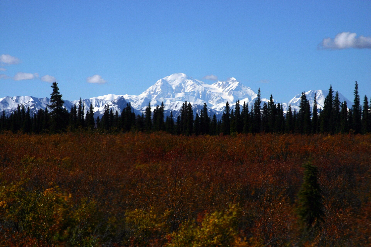
Alaska needs its own map and route logic. Anchorage, the Kenai Peninsula, Denali and the southeast coast do not form a short sightseeing loop. Some experiences involve rail, boat or air transport rather than a continuous road journey. Choose the corridor and excursion type first, then reserve accommodation that works with those departures.
Current access should override an attractive older map. The National Park Service reports that Denali’s only park road is closed to all traffic at Mile 43 because of the Pretty Rocks landslide. Confirm the latest status and available bus routes directly before choosing an excursion. A map of the full road is useful orientation but cannot demonstrate that you can currently travel its entire length.
Hawaii: choose islands before choosing hotels
Each Hawaiian island requires a separate arrival and ground plan. Oahu, Maui, Kauai and Hawaii Island offer different combinations of urban life, coast and landscape. Choose based on your interests and available time, then examine the specific part of the island where you will stay. An island-wide label can conceal a substantial journey between your accommodation and the day’s activity.
Island changes involve flights and a new transfer rather than a road crossing. Keep the number of islands in proportion to the trip length. On any map, distinguish a public road from a trail or private access, and check local guidance for the exact place you intend to visit. A focused stay on one island can offer more variety than several rushed arrivals.
Continue planning your USA trip
Sources and further reading
- U.S. Census Bureau regions and divisions map
- Amtrak Northeast routes
- Denali current visitor access
- California official road conditions
FAQ
Are these the official USA regions?
The descriptions use practical travel areas. The Census Bureau has its own statistical regions and divisions; those official categories serve a different purpose from planning a holiday.
Can I judge Alaska and Hawaii travel distances from map insets?
No. Insets often use a different scale and move the states for readability. Use a separate geographic map and actual transport connections to plan their relationship to the mainland.
Should I plan a route by state?
State borders can be useful, but visitor routes often cross them. Group places by realistic connections, season and the experience you want rather than trying to complete a state checklist.