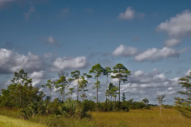
Florida · Photo spots
Florida Photography Locations: Coasts, Wetlands and Historic Streets
Choose one visual idea and a place where you can stay with it. A boardwalk curve, a bridge against open water or reflected city lights can make a coherent set of photographs. Travelling between several distant viewpoints during the same short day usually gives you more windscreen time than useful light.
The locations below are real visitor settings with different access limits. They are suggestions for making your own photographs, not promises that a particular animal, sky or foreground will be waiting. Personal camera settings should follow the movement and light you actually find.
Choose a subject before crossing the state
Swipe or scroll horizontally to compare all columns.
| Location | Subject to explore | Access decision |
|---|---|---|
| Bahia Honda | Old railway structure, water and island scale | State-park day entry; use the designated bridge trail |
| St. George Island State Park | Shoreline, dunes and open sky | Ordinary access begins at 8 a.m. and ends at sunset |
| H.P. Williams / Big Cypress | Waterway, cypress and wildlife in habitat | Work from the short public boardwalk |
| Black Point / Merritt Island | Wading birds and wetland layers | A daylight wildlife drive with a refuge pass |
| St. Augustine | Fort walls, waterfront and the historic town | Distinguish the grounds from paid fort entry |
| Tampa Riverwalk | City-water relationships and reflections | Choose one walkable section and a return route |
| Kissimmee Prairie Preserve | Open prairie and night sky | Arrange the appropriate after-hours access |
A wide view can be as specific as a close-up. In a wetland, the relationship between the animal and water may carry the picture; on a city walk, a foreground rail or passing figure can establish scale. Decide what belongs at the edges before changing lenses.
Photograph coastlines and the structures beside them
Bahia Honda: separate the old bridge from the beach scene
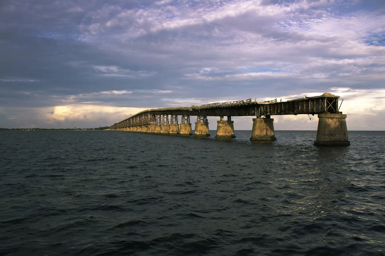
At Bahia Honda, begin with the designated trail in the Calusa area leading towards the old bridge. The park describes a route along the former U.S. 1 approach to a panoramic viewpoint. Use the permitted section and barriers as the limits of the outing; an image of the whole structure is not evidence that you can walk across it.
Try a wider frame that makes the bridge part of the island, then a tighter view of its repeating structure. Water can provide space around the subject, while shoreline vegetation can give the foreground scale. Keep the composition distinct from a swimming-beach photograph: a strong bridge view does not establish safe water access below it.
Day use is 8 a.m.–sunset; two adults arriving in one car pay $9 under the ordinary tariff, including the county surcharge. Leave time to return to the car before closing. For the beach session itself, use Florida beaches, and for the wider trip use the Keys guide.
St. George Island: work with dunes, shoreline and open sky
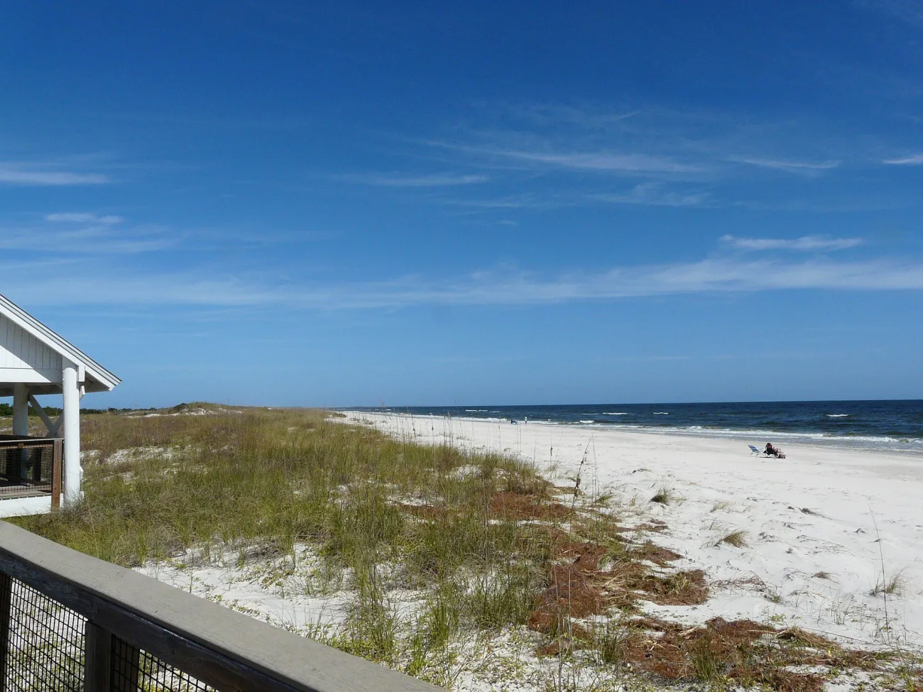
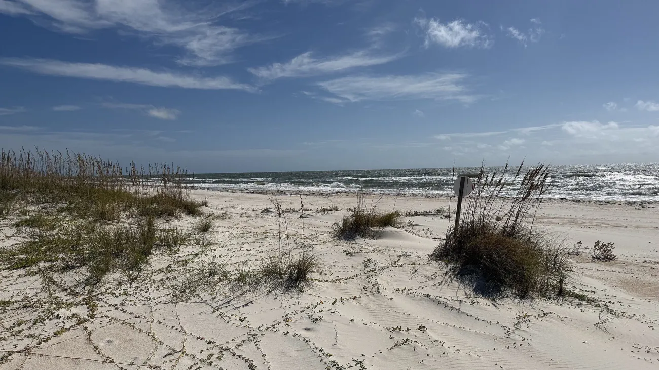
St. George Island's state park gives you a less built-up coastal setting. Work from designated approaches: a low viewpoint can use the shoreline as a leading line without climbing a dune. Turn towards the shape of clouds or the tide's marks when a familiar sunset composition is not developing. It is a place for staying with the changing scene rather than collecting an identical frame from every access.
The park opens 8 a.m.–sunset and charges $6 for a car with two–eight occupants. Ordinary day entry therefore does not automatically support a predawn session. The current notice closes the campground for renovation from 13 July 2026, so do not build an overnight photography plan around an assumed campsite. Use the day-use visit and another confirmed overnight base.
Choose wetland and bird photography without forcing an encounter
H.P. Williams: frame the waterway from the boardwalk
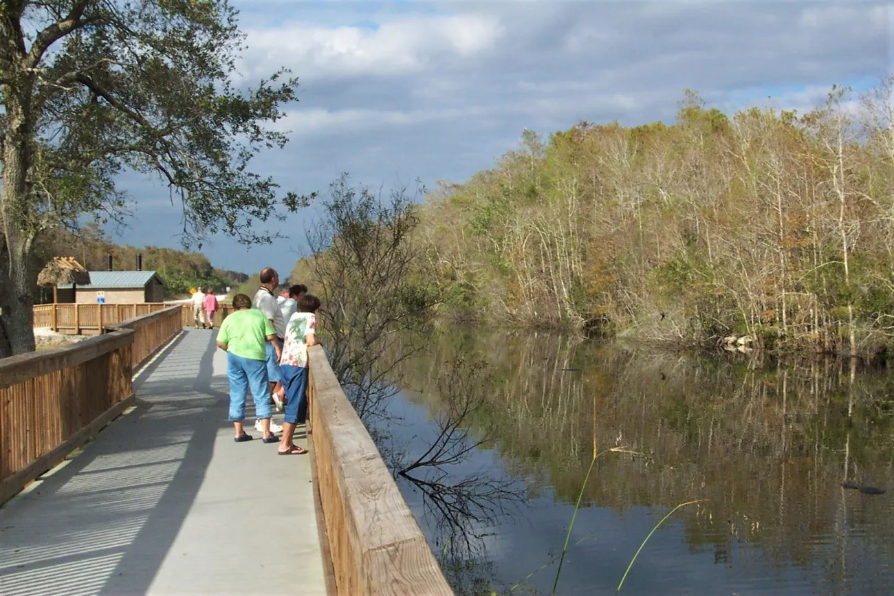
H.P. Williams Roadside Park in Big Cypress has a roughly 200-metre boardwalk overlooking a waterway and cypress-swamp setting, with an accessible entry, picnic tables and a vault toilet. Big Cypress is a separate preserve from Everglades National Park; name the place correctly when describing the resulting image.
Start with the waterway as a landscape. Look for a reflection, a gap between trunks or the relation between foreground growth and darker water. If wildlife appears, leave it room and use a longer view. A patient habitat picture is more useful than following an animal to make it fill the frame. On a narrow boardwalk, keep bags and tripod legs out of the passing space and be ready to lift the camera aside.
This short location can work for a visitor who does not want a long trail. It is still an exposed outdoor stop: arrive with drinking water, insect protection and a plan to leave if thunder develops. A roadside position should be reached through the public parking area, not an improvised stop on the highway shoulder.
Merritt Island: plan bird photography around Black Point

Black Point Wildlife Drive is a seven-mile auto tour through Merritt Island National Wildlife Refuge. Its attraction for photography is the ability to work with wetland views and observed birds from permitted stops. Give one promising place time instead of driving quickly in search of a guaranteed species. Watch the background, water surface and the direction of the bird's movement before making a tighter frame.
The refuge's visitor information lists road/trail access from sunrise to sunset, a $10 daily vehicle pass for Black Point and possible NASA launch restrictions. Download the pass before arriving. The same current source lists Oak and Palm Hammock trails temporarily closed after flooding; they are not dependable backup walks for this session. A launch can also restrict access even when the weather looks ideal.
Read historic buildings and city waterfronts as compositions
St. Augustine: frame the fort from a lawful waterfront position

A wider view of Castillo de San Marcos can connect the stone structure with water, the open foreground and the people moving around it. Begin with an authorised position on the grounds and decide how much of that setting you want. A closer wall detail tells a different story from a fort placed within the coastal city.
NPS hours close the grounds from midnight to 6 a.m.; the paid interior has its own 9 a.m. first entry and 5 p.m. last admission. Do not assume an exterior session requires buying interior admission, or that a late-evening picture allows access after midnight. If you want the rooms and gun deck as well, use the St. Augustine visit section to give that separate experience enough time.
Allow passing visitors to remain part of the public setting without pushing into their route. For an unobstructed composition, wait or adjust the framing; do not block a crossing or ask strangers to move out of an ordinary public walk.
Tampa Riverwalk: use reflections and the changing skyline
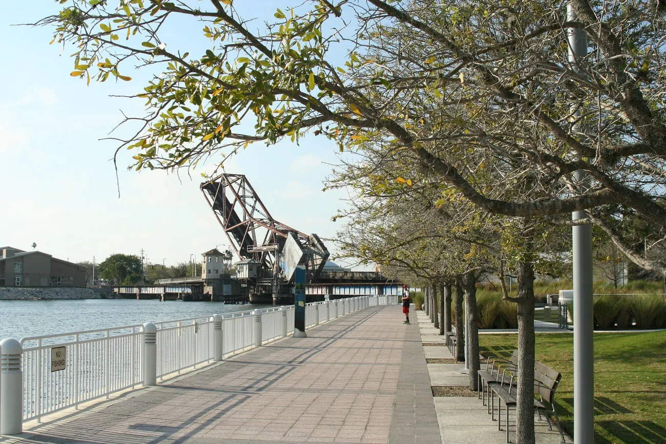
The Riverwalk organisation describes a free, 24-hour, 2.6-mile multi-use path between the Armature Works side and Sparkman Wharf. You do not need to complete it for a useful session. Pick a short section around a recognisable public meeting point such as Kennedy Plaza, identified by the City of Tampa, and work out the route back before dark.
Across water, the important choice is often the foreground: how much dark water, whether a railing helps describe the place, and how reflections relate to the buildings. Arrive while there is still light to judge that relationship, then watch which details remain as the sky darkens. Boat movement, wind and pedestrians all affect what a stable-looking composition can deliver. A longer exposure is a creative option, not a reason to obstruct a busy path.
Plan a night-sky session at Kissimmee Prairie Preserve
Reserve the access before planning the exposure
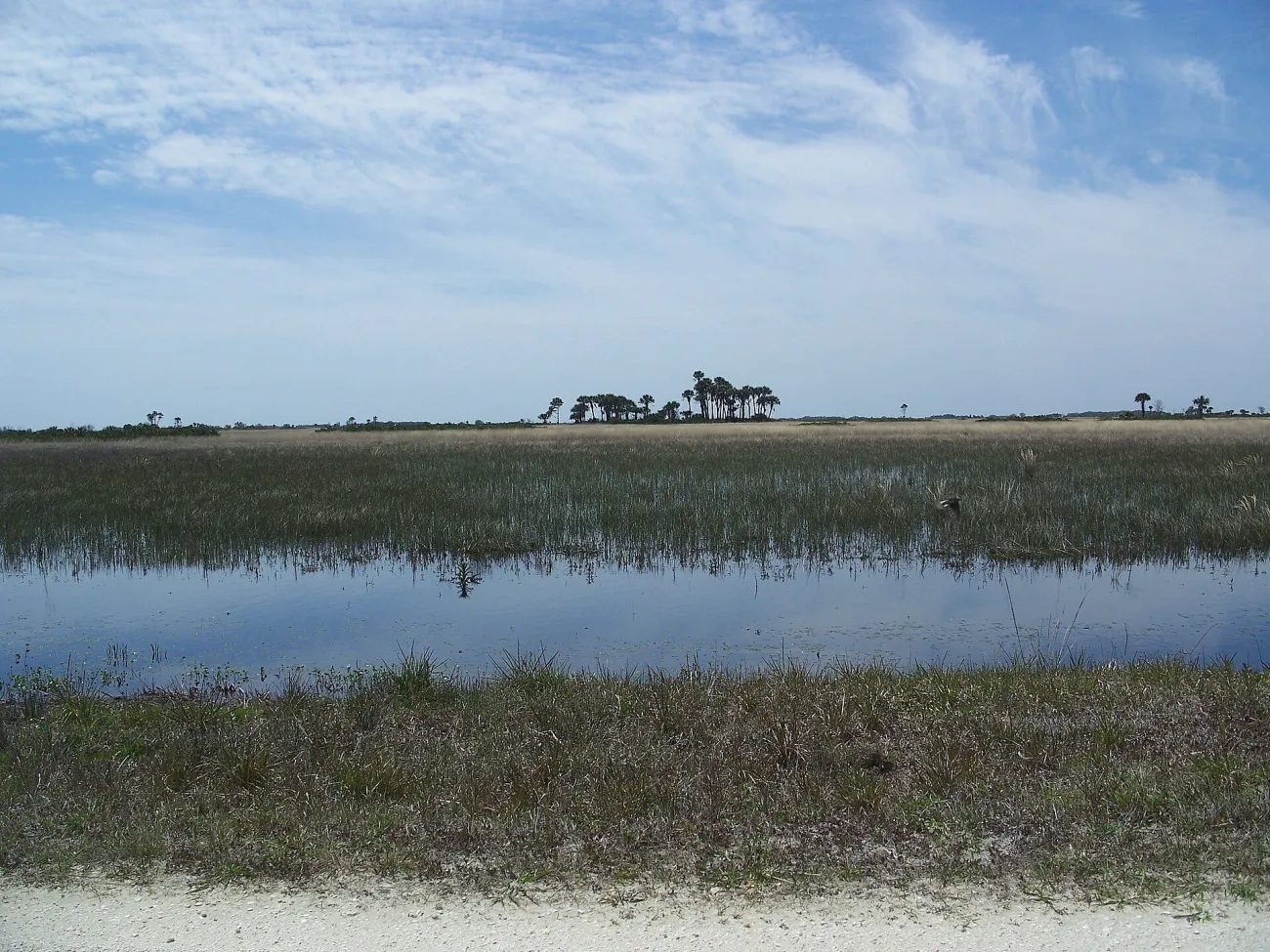
Kissimmee Prairie Preserve's astronomy guidance provides several routes to after-hours viewing. A reserved campsite or astronomy pad supports an overnight visit; astronomy-pad users must arrive before sunset and speak with the ranger. Red-spectrum lighting and no campfires apply at those pads. A Family Annual Pass holder can apply in person for the park's after-hours permit. That permit gives access to common day-use areas from as early as 5 a.m. until no later than 11 p.m.; it does not provide an overnight camping stay. The annual pass alone is not the after-hours permit.
If you cannot obtain those arrangements, the park describes a viewing area at the entrance, with a small pavilion and grass beside the kiosk. Entry fees still apply, and that area has no bathrooms. Beyond the gate, access is limited to registered campers or after-hours permit holders once the gate closes 15 minutes after sunset. Make the access decision first, then compare moon phase, cloud and your return journey.
Swipe or scroll horizontally to compare all columns.
| Decision | Practical action | Limit |
|---|---|---|
| Interior overnight session | Reserve camping or an astronomy pad and arrive before sunset | A day ticket is not unrestricted night entry |
| Eligible after-hours permit | Arrange it with the office under the park's terms | Family Annual Pass ownership alone is insufficient |
| Entrance-area viewing | Use the designated kiosk-side space and pay entry | No bathrooms; it does not open the interior road |
| Cost | Ordinary car entry is $4 for two–eight people | Camping and reservation charges are separate |
The published tariff starts standard camping at $16 per night before tax and reservation charges, with an additional nightly utility charge for RV units. Do not treat that as a guaranteed astronomy-pad quote. For the photographs, include some prairie or another lawful foreground if you want the image to describe this place rather than only a patch of sky.
Use light and season to adjust the same location
Swipe or scroll horizontally to compare all columns.
| Subject | Look for | Useful alternative |
|---|---|---|
| Coast | Cloud layers, wind, tide marks and the horizon | A closer shoreline pattern when the broad sky is flat |
| Birds | Behaviour, background and an undisturbed working distance | A wider habitat frame instead of a forced close-up |
| Historic walls | Side light, texture and the building's setting | Details in softer light rather than one front-on view |
| City after sunset | Balance between remaining sky and artificial lights | Reflections or a tighter grouping instead of every tower |
| Night sky | Clear conditions, moon phase and authorised access | A shorter session or another night; no promised Milky Way |
Sunrise and sunset belong to a date and location. Work backwards from the access hours and the time needed to reach the permitted viewpoint. A state park that closes at sunset may suit late-afternoon photography without offering a long blue-hour session afterwards. Wetland water levels and migration also change what is visible. Use the weather guide for season choice and the safety guide for storm and outdoor decisions.
Build a photography outing around one base
Swipe or scroll horizontally to compare all columns.
| Base or route | Location from this guide | Keep the rest manageable |
|---|---|---|
| Lower Keys | Bahia Honda | Combine with one shore stop; do not add a mainland sunset |
| Apalachicola / St. George Island | The island state park | Use a confirmed local overnight base while the campground is closed |
| Tamiami Trail / Big Cypress | H.P. Williams | Make a daylight stop within an already suitable road route |
| Titusville / Space Coast | Black Point | Give bird observation time; a complete KSC visit is another commitment |
| St. Augustine | Fort waterfront | Pair with a short town walk rather than another distant coast |
| Tampa | Riverwalk | One local meal and a clear route back |
| Kissimmee Prairie area | Authorised night-sky viewing | Prioritise access, rest and the late return |
Keep the photographic session more flexible than the hotel change or onward flight. An extra hour at one place can be more useful than another check-in on a list. Between regions, use Florida transport and the state itineraries to judge the journey.
Check permissions, equipment rules and wildlife boundaries
Under current NPS filming and photography guidance, an activity with eight or fewer people generally needs no filming/photo permit when it stays in public areas, uses hand-carried equipment, needs no exclusive space, creates no adverse impact and adds no administrative cost. Commercial status alone no longer determines the answer. Other activity rules and entrance fees still apply, and a business running a workshop may need separate authorisation.
Other managers have different systems: the Riverwalk FAQ directs paid commercial filming/photography to the local film-permit process. Describe the actual shoot—group size, equipment and use of space—when asking permission. Drone launch and airspace permissions are separate questions; a handheld-photo arrangement does not establish drone access. Never use an online aerial image as evidence that your own flight is allowed.
For wildlife, leave nests, resting groups and feeding routes undisturbed. Do not use food, calls or a closer approach to manufacture the picture. Ask before making an identifiable person the main close subject, and respect working entrances. A public position can make an exterior photograph possible without granting access to a building or permission to reproduce every artwork inside it.
Explore the existing Florida photo collection
The existing Florida collection includes Cape Canaveral, Epcot Center, Magic Kingdom, Miami Streets, Saint Augustine and the Everglades. View them as individual photographs, with their own source and date context, rather than current opening or access instructions. For an independent Miami session, continue with Miami photo spots.
Sources and Planning Checks
The linked land-manager and Riverwalk pages were read on 11 November 2026. Their access hours, pass conditions and current notices support the location choices here. Those limits are part of the photographic plan: arriving before a gate closes matters more than carrying another lens. The Florida guide connects these individual outings with the wider trip.
Florida Photography FAQ
Where should you start for landscape photography in Florida?
Choose the setting closest to the trip you already want: a Keys bridge-and-water view, St. George Island's coast or a local wetland. One place with time to observe is a better beginning than a statewide list.
Which Florida photography locations work without a long hike?
H.P. Williams has a short boardwalk; Tampa Riverwalk allows a session on one small section; permitted St. Augustine grounds can support an exterior visit. Check the actual route and access you need.
Can you photograph wildlife without booking a boat trip?
Yes. Black Point is an auto tour, while a boardwalk such as H.P. Williams offers land-based observation. Animals remain free to appear or stay out of sight.
Can you enter Kissimmee Prairie Preserve after sunset?
Interior access after closing requires registered camping or the appropriate after-hours permit. For Family Annual Pass holders, that permit covers common day-use areas only between 5 a.m. and 11 p.m.; an overnight session needs the appropriate campsite or astronomy-pad reservation. The park also describes a designated entrance-area viewing option.
Do you need permission for a tripod, drone or organised photo session?
It depends on the manager and the actual activity. NPS has specific small-group conditions; other public land and private venues use different rules. Drone access is separate, and equipment must never block other visitors.