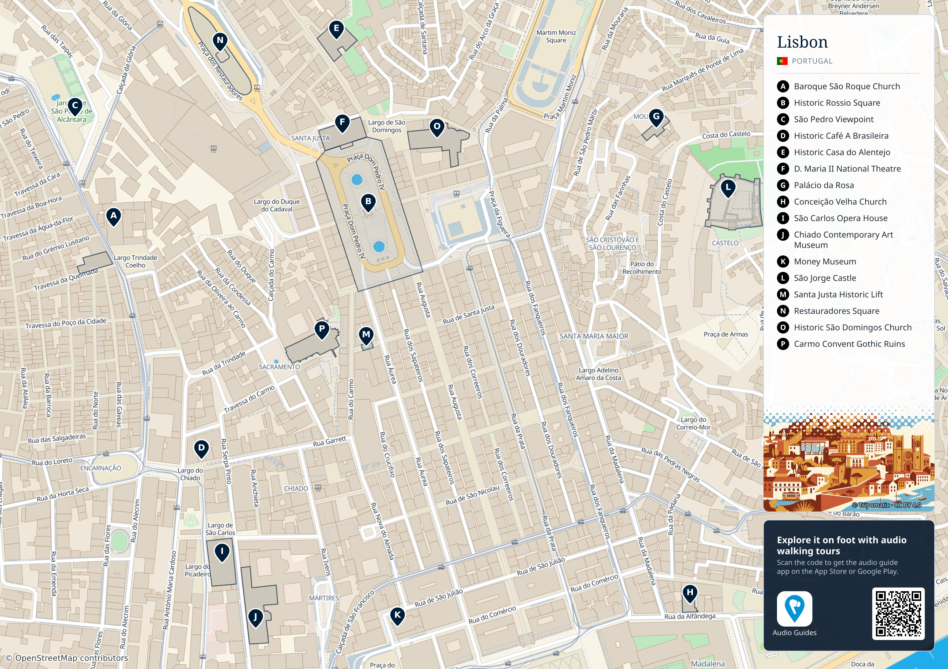
Use this street map for the central Rossio–Chiado–castle area. It labels sixteen landmarks, A–P, and retains the source map’s street names and geographic layout. Belém, Parque das Nações, the airport, Sintra and Cascais are outside this map’s detailed extent; the district descriptions below explain how to plan them separately. This is an orientation map, not live routing, a step-free access survey or a current transit diagram.
Use districts as separate route blocks
| Route block | Connect locally | Avoid treating as the same walking loop |
|---|---|---|
| Baixa / Praça do Comércio | The grid, riverfront and a planned uphill extension. | Belém or Parque das Nações. |
| Alfama / Sé | Older lanes and hillside viewpoints. | A step-free continuation just because two points look close. |
| Belém | Jéronimos and waterfront monument exteriors. | A timed old-centre visit immediately afterwards. |
| Parque das Nações | Oriente-area plans and the modern riverfront. | The historic-centre sightseeing circuit. |
Use the map to group places before searching for transport. A route with several nearby stops can still involve climbing, steps and a busy road crossing. Check the actual pedestrian approach and allow a break rather than converting straight-line distance into a walking promise.
Save the accommodation entrance and your booked attraction address before leaving Wi-Fi. An offline map is useful for orientation, but live closures and transit changes still need an operator check. If a route becomes uncomfortable, shorten the uphill part instead of trying to recover time by hurrying.
Historic centre: Baixa, Chiado and the Alfama hillside
Praça do Comércio and Baixa provide a starting area for central sightseeing. Chiado lies on a different level, while Alfama and the castle-side lanes require more attention to slopes and steps. A short distance on a map can still be a demanding walk.
Group stops within one of these areas rather than repeatedly moving between hills. Choose your station exit and building entrance with luggage or access requirements in mind.
Belém: a separate outing to the west
Treat Belém’s monuments and riverfront as their own block of time. Account for the journey from the centre and any booked admission. It is not an immediate continuation of every Alfama or Chiado walk.
Parque das Nações: a different riverside district
This contemporary district is useful to identify when visiting the Oceanário, using Oriente or attending an event in the area. A hotel here gives a different base from the historic centre; compare the journeys you intend to make.
The coast and Sintra are day-trip choices
Cascais and the beaches on the western coast lie outside the central city itinerary. Sintra is a separate destination with its own onward journeys and palace entry arrangements. The place label alone does not provide a door-to-door travel time.
Match the map to current transport
Use Metropolitano de Lisboa for the current metro diagram and service information, and the airport transport guide for arrival choices. Check the operator and destination before choosing a ticket.
How to use the guide
- Mark your accommodation and the exact entrance.
- Choose a compact sightseeing area for each part of the day.
- Add transport for distant districts, allowing for the final walk.
- Check steps, access and booking conditions separately from geographic distance.
Read Things to Do, Getting Around and Where to Stay to turn orientation into a workable itinerary.
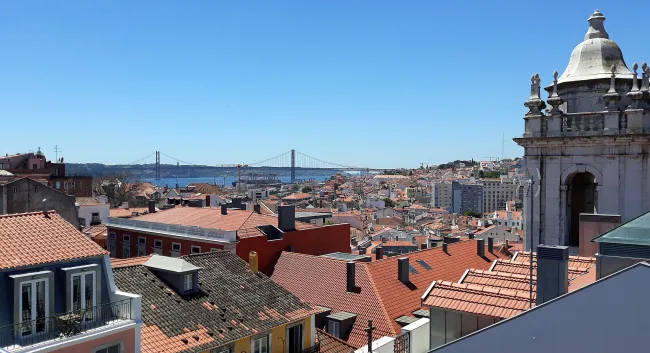
Original Lisbon location illustration (opens the existing image file).
Practical information reviewed 7–8 October 2026. Recheck linked operators for current prices, opening, ticket availability and access before booking. Route and photography suggestions are editorial planning guidance.
Read the map before choosing a route
Rossio is B, the São Pedro viewpoint C, São Jorge Castle L and Carmo Convent P. Use the letter key in the full-resolution file to identify the other marked places. A short line across the map may cross a change in level; the printed street network does not guarantee an accessible route. For journeys outside the centre, use the operator’s current network diagram and service information.