
Sign in
For Photos4Travel editors and team members.
Puerto Rico · Map & Regions
Puerto Rico Map & Regions: Where Places Fit in Your Trip
Use a real Puerto Rico planning map to connect San Juan, El Yunque, the west, south, Vieques and Culebra, then choose bases that reduce backtracking.
On this page · 9 sections ShowHide
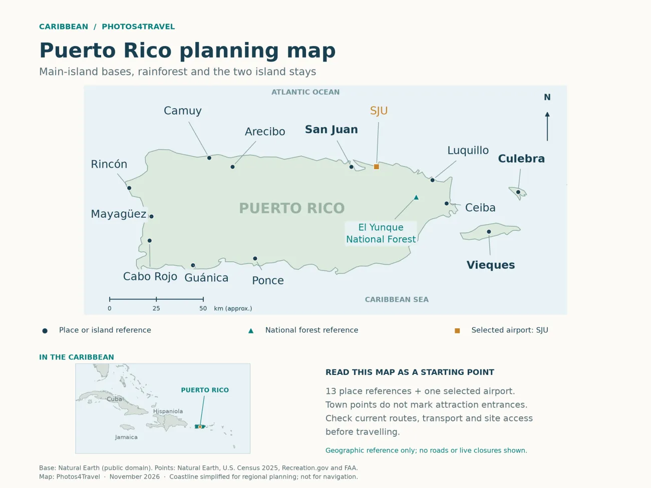
Open the full-size Puerto Rico map
Puerto Rico sits in the northeastern Caribbean, east of the Dominican Republic and west of the Virgin Islands. On a travel map, the important distinction is between the main island, the mountain interior, and the offshore islands of Vieques and Culebra. A route that follows the mainland coast is a road trip; adding either island introduces a separate flight or ferry journey and a different local transport arrangement.
Use this guide to understand where places sit and which ones belong together. The accommodation guide compares where to sleep, while getting around explains the vehicles, connections and booking decisions. A planning map can show a useful relationship between places without guaranteeing a road’s condition, an attraction’s opening or tomorrow’s journey time.
The map uses approximate regional and place labels for orientation. The selected SJU airport is shown to explain the route; it is not a complete airport inventory, a road-navigation map or a current closures map. Use the actual terminal, entrance and land-manager information for the final approach.
Read the map as a set of travel areas
The capital area lies on the northeast coast. El Yunque and the northeastern beach towns sit farther east; Ceiba is the mainland gateway for the island ferries. Rincón and Aguadilla are on the west, Ponce is on the south, and Cabo Rojo occupies the southwest. The interior separates routes that look close when measured straight across the map.
The tourism board’s regional overview is useful for exploring the island beyond San Juan. Its travel regions should not be confused with a province system or a promise that every stop in the same region is a quick drive. For accommodation, pin the exact address before booking; a broad regional label can hide a long daily drive.
Swipe or scroll sideways to compare the full table.
| Area | Useful anchors | Planning implication |
|---|---|---|
| Metropolitan northeast | Old San Juan, Condado, Isla Verde, SJU | Good starting point for a trip with limited driving |
| Eastern mainland | El Yunque, Luquillo, Fajardo, Ceiba | Group forest, coast and island-departure logistics |
| West and southwest | Aguadilla, Rincón, Cabo Rojo | A second base avoids repeated cross-island drives |
| South and interior | Ponce, Guánica, mountain towns | Terrain and access matter more than straight-line distance |
| Offshore islands | Vieques, Culebra | Separate tickets, local transfers and weather margin |
The San Juan area: distinguish city districts and airports
Old San Juan occupies the historic western end of the capital’s island setting. Condado and Ocean Park lie farther east along the metropolitan coast; Isla Verde is in Carolina, near SJU. These names are often grouped together in holiday searches, but the daily experience changes: historic walking, urban beach access and airport convenience are different priorities.
Do not assume the closest-looking beachfront hotel is a comfortable walk from Old San Juan. Plan the actual route, crossings and return transport. For a short city stay, a central address can remove the need to park a rental car every night. Rent for the regional part of the journey if the first days are mainly walking and museums.
SJU means Luis Muñoz Marín International Airport. SIG means Fernando Luis Ribas Dominicci, commonly called Isla Grande. A transfer between them is an overland journey, not a change of terminal. Keep the airport code beside each booking, especially when using small-plane services.
The eastern mainland: forest, beaches and Ceiba
Río Grande and Luquillo make useful geographical reference points for El Yunque. Fajardo lies farther along the northeastern coast, with Laguna Grande nearby; Ceiba is farther southeast and serves the passenger ferries. A hotel described as being “near El Yunque” may still require a car or arranged transport to reach the authorized forest access.
The north-side recreation corridor and the Angelito trailhead use different approach roads. Navigate to your chosen trailhead or visitor center so that you reach the appropriate approach road. Current Forest Service conditions should decide which stops remain possible. A map label cannot tell you whether a parking area or tower is available.
For a forest-and-coast day, keep the beach stop on the same side of the island. For an island departure, consider sleeping near the eastern gateway beforehand. The journey to Ceiba is only one part of the transfer: parking, check-in, sailing and onward island transport still follow.
The west: stay long enough to use the coast
Aguadilla and Rincón are useful western anchors, with different airport, town and coastal settings. Staying in this area can make sense when several of your chosen activities are already in the west. Repeated day trips from San Juan replace beach or town time with driving, and a west-coast evening also leaves a long return.
A western base is not the same as being within walking distance of every beach. Pin each access point, identify parking and confirm how you will return from a dinner or surf outing. A beautiful stretch of coast may have no convenient public transport. Check conditions before treating a surf beach as a swimming stop.
Ponce, Guánica and Cabo Rojo: keep the distinctions
Ponce is a southern urban base with a historic center. Guánica is associated with dry-forest landscapes farther west. Cabo Rojo and La Parguera sit in the southwest, but they are separate destinations with their own access and parking questions. They should not be compressed into one undifferentiated “south coast” beach afternoon.
Choose a southern overnight when your interests include town visits, southwestern scenery or a late activity in La Parguera. If the next booking is back near San Juan, make the move an intentional transfer day. Adding several sightseeing detours can consume the time you expected to spend at the destination.
The drier southern landscape is a useful contrast with the northeast rainforest. It is also a reason to carry water and assess heat exposure on a walk. Regional climate helps select the experience; local weather and access rules still determine whether it is sensible that day.
The interior and north coast need their own planning
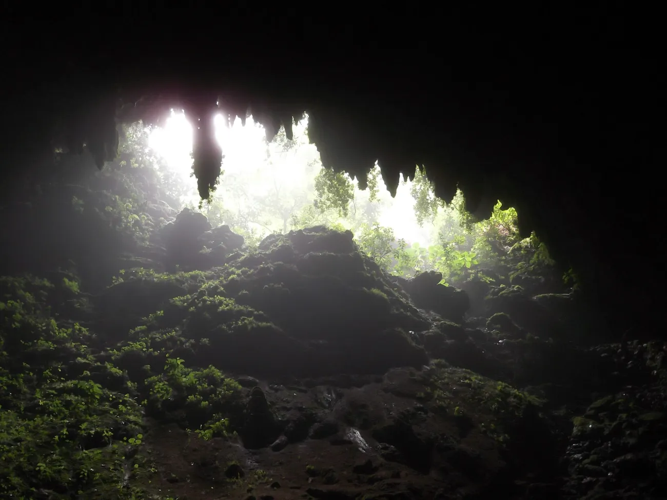
Photo: Rio Camuy Cave Park - Flickr - Jay Sturner — Jay Sturner from USA · CC BY 2.0 · Resized.

The mountain interior rewards a different pace from a motorway transfer. Choose a town, coffee-related visit or walk with confirmed access, then check the approach and return road. Roads may be winding and narrow; a route that looks efficient on a small map can be tiring when combined with stops and an evening drive.
North-coast names such as Arecibo and Camuy help you place attractions between the capital and the west. Avoid using historic photographs as access information. In particular, the intact Arecibo radio telescope belongs to the historical record: the 305-meter instrument collapsed in 2020, as documented by the National Science Foundation. Confirm any present-day visit separately.
Vieques and Culebra are journeys, not map shortcuts
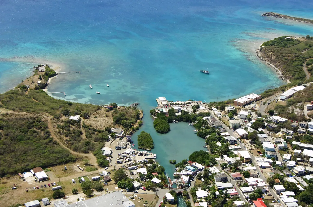
Photo: Aerial of Dewey, Culebra. Looking south west at the ferry landing — Steven595 · CC BY-SA 4.0 · Resized.

Vieques and Culebra lie east of the main island. The ferry operator lists Ceiba routes to each; do not route yourself to the old Fajardo terminal or assume that San Juan’s Cataño ferry is the island service. Confirm both the destination and the terminal on the ticket.
Allow for a different vehicle arrangement after landing or sailing. Rental cars from the main island cannot be carried on the ferry. A day visit needs an achievable return; a nighttime Vieques experience is better matched with an overnight. Keep an additional mainland margin when the trip ends with a flight.
Turn the map into a manageable route
For six nights, San Juan plus an eastern base is a compact combination. For nine nights, decide between a mainland east-to-west route and an eastern trip with one island. With thirteen or twenty nights, you can add the south and longer stays while retaining weather flexibility. These are route shapes, not requirements to visit every region.
Travel Tip: Save two maps: one showing your overnight bases and one showing the actual entrances, terminals and parking points. The first prevents backtracking; the second prevents arriving at the wrong gate.
Puerto Rico map questions
Can I drive between all the places on the map?
No. The mainland destinations connect by road, while Vieques and Culebra require separate air or ferry transport. A planning map also does not establish that every marked road, gate or visitor facility is currently open.
Is one hotel enough for the whole island?
It can be enough for a focused trip. If several planned days are on the opposite coast, a second base usually makes the route less repetitive. Compare actual daily journeys before deciding that a central-looking address saves time.
Should I choose my airport or hotel first?
Work on them together. Match the arrival airport and flight time with the first overnight base, and examine the return journey too. A cheaper flight can lose its advantage if it requires an inconvenient late transfer or another hotel night.
Does the map show every airport and protected area?
No. It is a selective travel-planning map for the places discussed in this guide. Use the relevant airport, transport or land-manager source for complete operational information, current access and detailed navigation.