
RUSSIA · COUNTRY GUIDE
Russia Photos & Photo Spots
A useful photo plan starts with a real place, an authorised position and enough time to respond to the light. The four settings below show different possibilities: a city column against the evening sky, a river and church landscape, Baikal cliffs and a Pacific lighthouse. The photographs illustrate those settings; they do not prove current access, weather or permission to reproduce the viewpoint.
Read Health & Safety before considering a journey. Current UK advice is against all travel to Russia and the US advisory is Level 4, Do Not Travel. Photography adds its own restrictions around military sites, strategic infrastructure, security activity, performances and some interiors. A publicly visible scene is not universal permission to photograph it.
Compare the four settings
| Setting | Composition opportunity and practical limit |
|---|---|
| Strelka area, Saint Petersburg | A Rostral Column, city silhouettes and changing sky. Check the public position, wind, crossing and return rather than chasing one exact sunset. |
| Kamenka River, Suzdal | Water, vegetation and church forms in a quieter-scale landscape. Stay on authorised paths and check ground conditions. |
| Olkhon Island, Baikal | Layered capes, cliffs and water. Viewpoints may involve protected land, long transfers and exposed edges. |
| Tokarevsky Lighthouse, Vladivostok | A lighthouse and coastal approach in a maritime setting. Water level, waves, access and nearby restrictions can change the plan. |
Saint Petersburg: the Strelka and a Rostral Column
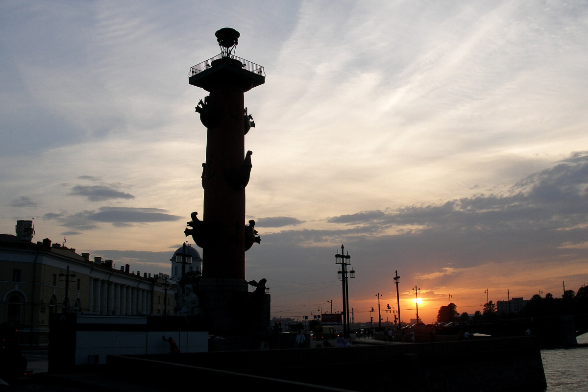
The Strelka of Vasilievsky Island is a recognisable urban setting where a Rostral Column and the surrounding city can be composed against a changing sky. The photograph uses the column as a dark vertical form rather than trying to show every architectural detail. That is one approach to the scene, not a required camera position or an assurance of the same light.
For a similar visual idea, decide whether the column, waterfront or sky is the subject. Leave enough space around the silhouette to keep its outline clear, and avoid placing a bright patch of sky where it obscures the form you want. A wider view can explain the urban setting; a tighter view can simplify a busy scene. Neither requires entering a restricted position.
Check the current public route, road crossings and the journey back to your accommodation. Wind and rain can affect exposed positions beside the water, and late light can conceal how tired you are. Keep equipment out of pedestrian flow. A tripod or commercial setup may need a separate permission check even where ordinary handheld photography is allowed.
Suzdal: Kamenka River and church forms
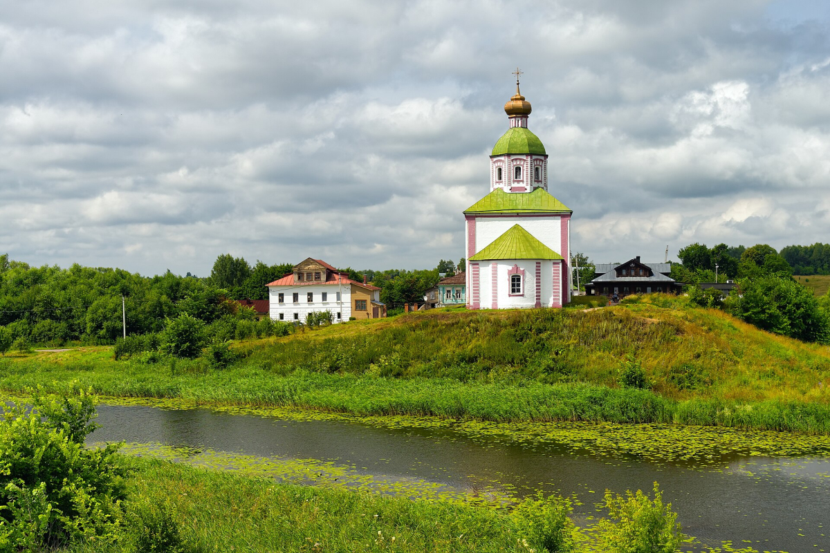
The Kamenka River gives Suzdal a landscape scale that differs from a close façade photograph. In this image, the Church of Elijah the Prophet, vegetation and water sit together in the frame. The subject is the relationship between built form and setting, not proof that the bank is an unrestricted walking route or that an interior is open.
Use the waterline and vegetation to organise the foreground without trampling plants or leaving a marked path. Reflections depend on wind, water level and the position of the sun; they cannot be guaranteed for a particular hour or month. If the water is textured, a composition that includes the wider landscape may work better than waiting indefinitely for a mirror surface.
Check the actual approach, surface and return in the season you intend to visit. Wet ground, ice or a steep bank can make a short-looking route unsuitable. Do not enter private land, gardens or worship areas to recreate an image. A respectful photograph can be made from a different authorised position rather than forcing the original viewpoint.
Lake Baikal: Olkhon's capes and cliffs
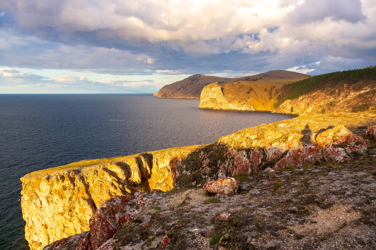
Olkhon's capes offer layered landforms, water and changing light. The photograph illustrates cliffs at sunset, with the contrast between the nearer rock and the receding coast giving depth. It does not identify a maintained trail, a safe cliff edge or the pickup point for an excursion. Confirm the actual location and access with the responsible authority or competent local provider.
Work with the landforms that are safely visible from an authorised position. A longer focal length can compress layers; a wider view can include foreground and the scale of the lake. Do not step towards an exposed edge merely to remove a distracting foreground. Wind, unstable ground and limited communication can make a small movement consequential.
Olkhon is a separate travel commitment from Listvyanka or an urban Irkutsk stay. Check the seasonal approach, accommodation, permits and return. The photograph is not a winter-ice route. Never infer safe ice from a previous image, vehicle track or air temperature. If conditions do not support the planned outing, choose a simpler shore setting near the base.
Vladivostok: Tokarevsky Lighthouse
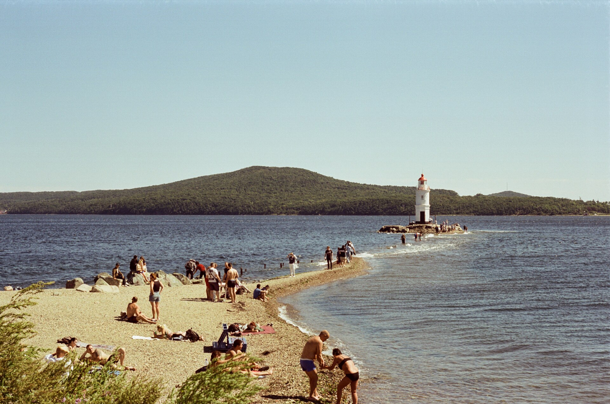
Tokarevsky Lighthouse provides a coastal subject with a clear vertical form and an approach shaped by the water. The image includes people and shore context, showing that the lighthouse is part of a wider setting rather than an isolated graphic object. It records conditions at the time of the photograph, not current public access or a safe crossing.
Choose whether the lighthouse, the approach or the surrounding water is the main subject. Keep the horizon deliberate and avoid cropping the structure awkwardly if a slightly wider authorised position is available. A photograph with changing waves or people can be more informative than a frame that tries to remove every sign of use. Ask before making an identifiable person the primary subject.
Water level, waves, wind and access restrictions can affect the approach. Do not cross water or an exposed strip solely to reproduce a viewpoint. Vladivostok also has naval and strategic sites: avoid photographing restricted infrastructure or security activity. A scenic map label does not override signs, local instructions or current law.
Light and season: plan possibilities
Long summer evenings in Saint Petersburg create a different working window from short winter days. Baikal and Vladivostok have their own seasonal and weather patterns. Check the local forecast and the light for the actual date, but do not turn a planning tool into a promise of sunset colour, clear air or a visible reflection.
Allow time for observation from a safe, authorised position. If the light is flat, look for building detail, relationships between forms or a documentary wider view. A successful day does not require the dramatic conditions shown in a selected photograph. Best Time to Visit explains the broader seasonal differences without promising a specific photographic outcome.
Permissions, people and equipment
Check each museum's current rules for ordinary photography, flash, tripods and commercial work. A ticket to enter is not necessarily permission for every type of equipment or publication. Performances often have separate restrictions. In worship settings, follow the current instructions and avoid interrupting services or photographing people who have not agreed.
Do not photograph military establishments, strategic infrastructure, political activity or security operations. Drone use requires separate legal and local checks and is not presented here as a casual way to obtain a better viewpoint. If a position is restricted, choose a different subject; an image from another year is not an exemption.
Carry only equipment you can manage while keeping documents and essentials secure. Use a comfortable bag, protect batteries and devices from the conditions and keep the return route available offline. In cold weather, shorter sessions and indoor breaks may be more practical than waiting exposed for a particular frame. Do not make the equipment the reason to take an unsafe route.
Use photographs responsibly
Captions should identify what is visible and distinguish the recorded scene from current visitor conditions. Do not label a generic lake photograph as a specific trail or imply that a distant hotel view proves room quality. If a photograph's date matters to changed access or infrastructure, include that context rather than treating every image as current evidence.
The images on this page are licensed photographs with visible source and credit information. They support researched interpretation; they are not claimed as the author's own fieldwork. Use Map & Regions for orientation and Top Destinations for place selection. Confirm the final approach and permission before using any photographic idea as a travel plan.