
User login
Cayman Islands Map
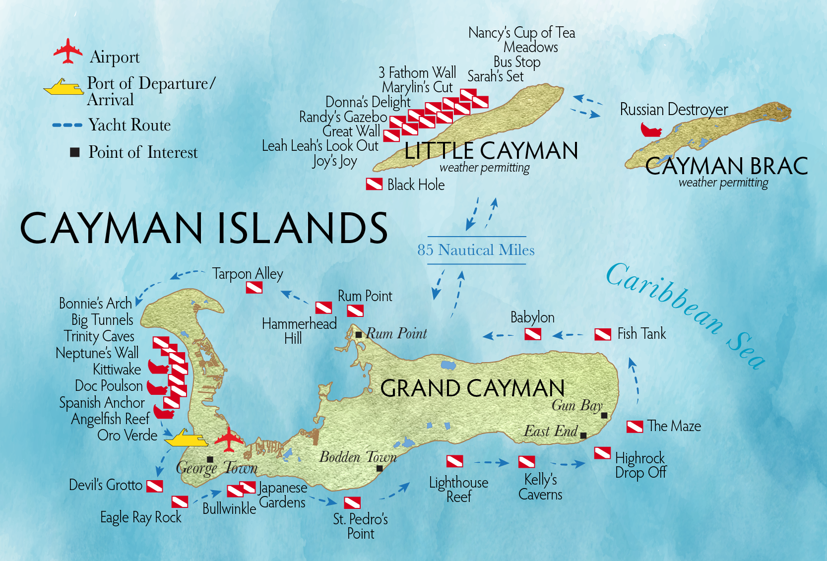
Understanding the geography of the Cayman Islands makes trip planning easier, especially when deciding where to stay, how to move between islands and which areas to explore. The archipelago contains three islands—Grand Cayman, Cayman Brac and Little Cayman—each with distinct landscapes and travel experiences. This guide explains the layout of the islands, highlights major regions and offers practical insights on transportation, distances and navigation.
If you want a quick introduction to the islands as a whole, you can also read the Cayman Islands Fast Facts page for additional context.
1. Detailed Cayman Islands Map
The map below offers an overview of the three islands and their relative positions in the Caribbean Sea. It helps travelers understand the scale of each island, ferry distances and the distribution of natural attractions, beaches and towns.

2. Where Are the Cayman Islands Located?
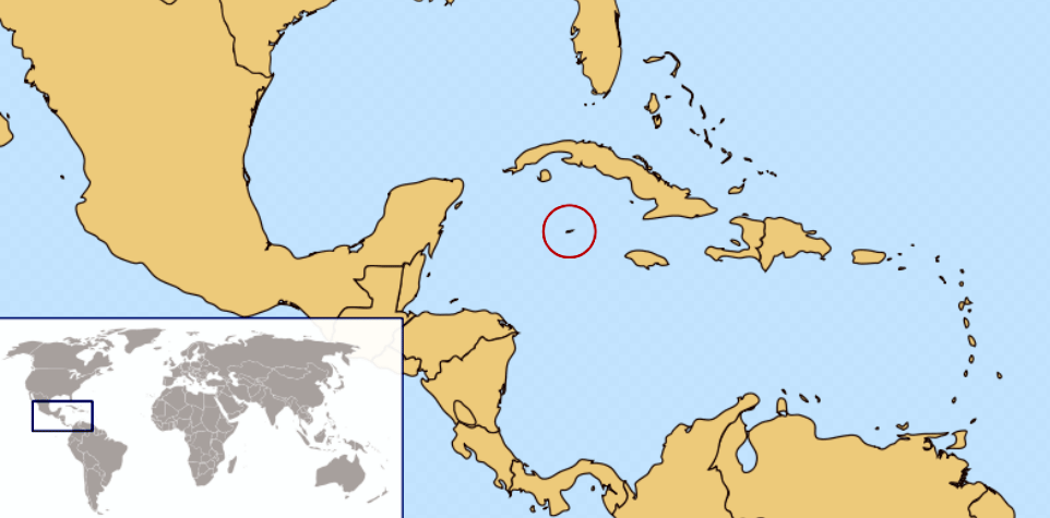
The Cayman Islands lie south of Cuba and northwest of Jamaica, positioned in the warm waters of the western Caribbean Sea. This location gives the islands a tropical climate, excellent diving conditions and calm, clear seas ideal for snorkeling and marine activities.
The map below shows the geographic position of the Cayman Islands within the region, making it easier to understand flight routes and regional connections.
3. Understanding the Three Islands
Each island has a unique character, travel style and natural environment. Exploring the map helps travelers choose accommodation and plan movement between the islands.
Grand Cayman
The largest island and home to the capital, George Town. It features:
- Seven Mile Beach: the most famous resort area.
- West Bay: beautiful coastal drives and diving spots.
- East End: quieter beaches, nature and local culture.
- North Side: Rum Point and tranquil coves.
Cayman Brac
Known for dramatic cliffs, hiking trails and a more rugged landscape. Popular with nature lovers and divers seeking a quieter island.
Little Cayman
A peaceful island with untouched beaches and world-famous dive sites such as Bloody Bay Marine Park. Ideal for travelers who want a private, natural retreat.
4. Key Towns and Regions Shown on the Map
While the islands are relatively small, each region offers different accommodations, restaurants, beaches and activities. Some of the main areas visitors will see on the map include:
- George Town – capital and economic center.
- West Bay – diving, beaches and family attractions.
- Bodden Town – the oldest settlement on Grand Cayman.
- East End – quiet coastal resorts and local experiences.
- Cayman Brac East/West – hiking routes and heritage sites.
- Little Cayman South/Blossom Village – remote beaches and lagoons.
5. How to Use the Map for Trip Planning
The Cayman Islands are easy to navigate thanks to clear roads, short travel distances and well-marked beach access points. Reviewing the map before arriving helps with:
- Choosing the right region for your hotel.
- Estimating travel times between beaches and towns.
- Planning day trips across the island.
- Understanding ferry and flight connections to Cayman Brac & Little Cayman.
6. Distances Between Key Locations
Driving distances on Grand Cayman are short, making it easy to explore multiple areas in a single day:
- Seven Mile Beach → George Town: 10 minutes
- George Town → North Side: 35 minutes
- George Town → East End: 40 minutes
- Grand Cayman → Cayman Brac: 40 min flight
- Cayman Brac → Little Cayman: 10 min flight
7. Navigation Tips
Most travelers find navigation easy thanks to English-speaking locals and well-maintained roads. Offline maps are useful when exploring remote areas of Cayman Brac and Little Cayman.
Travel Tip
Download offline maps for Grand Cayman, Cayman Brac and Little Cayman before your trip. This ensures you can navigate beaches and nature areas even with limited mobile coverage.
8. Continue Planning Your Trip
Now that you understand the layout of the islands, you may want to explore: